Buddhist Master Trail
Tour Details
Short Itenary
Day 01: Arrival in Kathmandu
Day 02: Sightseeing in Kathmandu Valley
Day 03: Kathmandu-Panauti & Namo Buddha (1 672 m)
Day 04: Namo Buddha to Kot Timal (1 714 m)
Day 05: Kot Timal to Chapakhori (1 755 m)
Day 06: Chapakhori to Nepal Thok (Mahadevsthan) (508 m)
Day 07: Jeef Safari to Sindhuli Gadi (1 700 m) & back in Nepal Thok
Day 08: Nepal Thok to Shikarpur (1 656 m)
Day 09: Shikarpur to Katarche Danda (1 865 m)
Day 10: Godechuli Danda (2 361 m) to Deurali Danda (1 421 m)
Day 11: Deurali Danda to Kalo Dunga & back drive to Kathmandu
Day 12: Rest day and Shopping
Day 13: Fly back home
Itinerary
Pick-up at Tribhuvan International Airport, meeting with your guide and transfer to the hotel. First impressions of Kathmandu (1 350 m) – walk to medieval Kathmandu Durbar Square and explore the beautiful complex of palaces, temples, shrines and courtyards built by the ancient Nepali kings between the 12th and 18th century. We bring you to our office and Thamel – the vibrant tourist area with hotels, restaurants, bakeries and outdoor shops. We get to know each other over a welcome dinner, check formalities and equipment and discuss your itinerary.
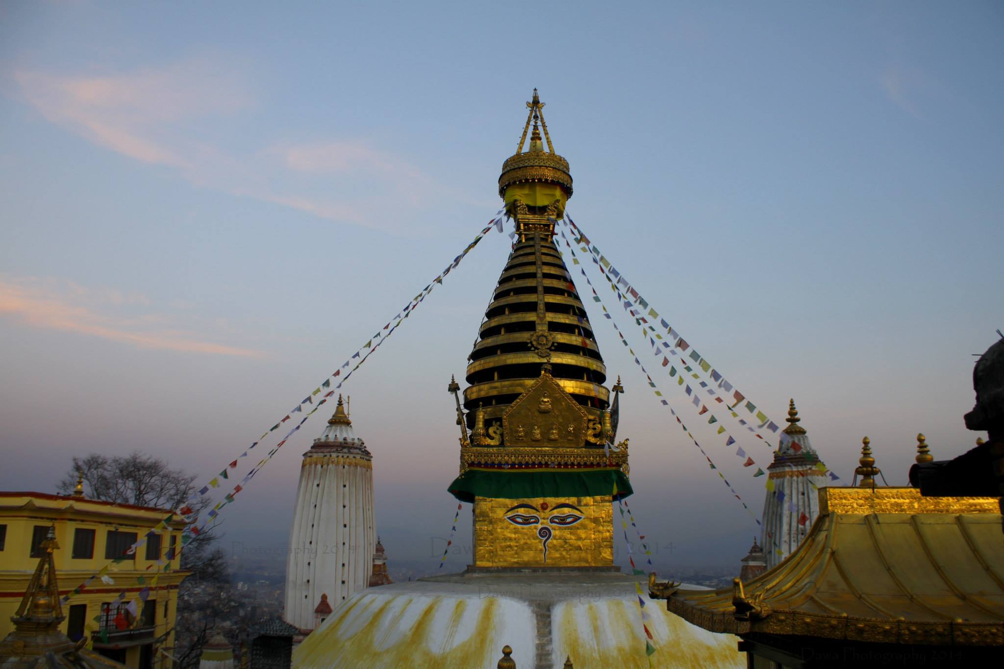
Today we discover the highlights of Katmandu and the valley. We adapt the programm to your interests and desires and what you have seen before. Usually, we go to Pasupatinath on the bank of the Bagmati River, where the most important Hindu temples and burning ghats of Nepal are situated. In Bouddhanath we circumambulate together with Tibetan and Nepali Buddhist pilgrims the whitewashed Stupa. Our sightseeing usually ends in Patan, the city of Beauty, an astonishing center of fine art and Buddhist and Hindu culture.
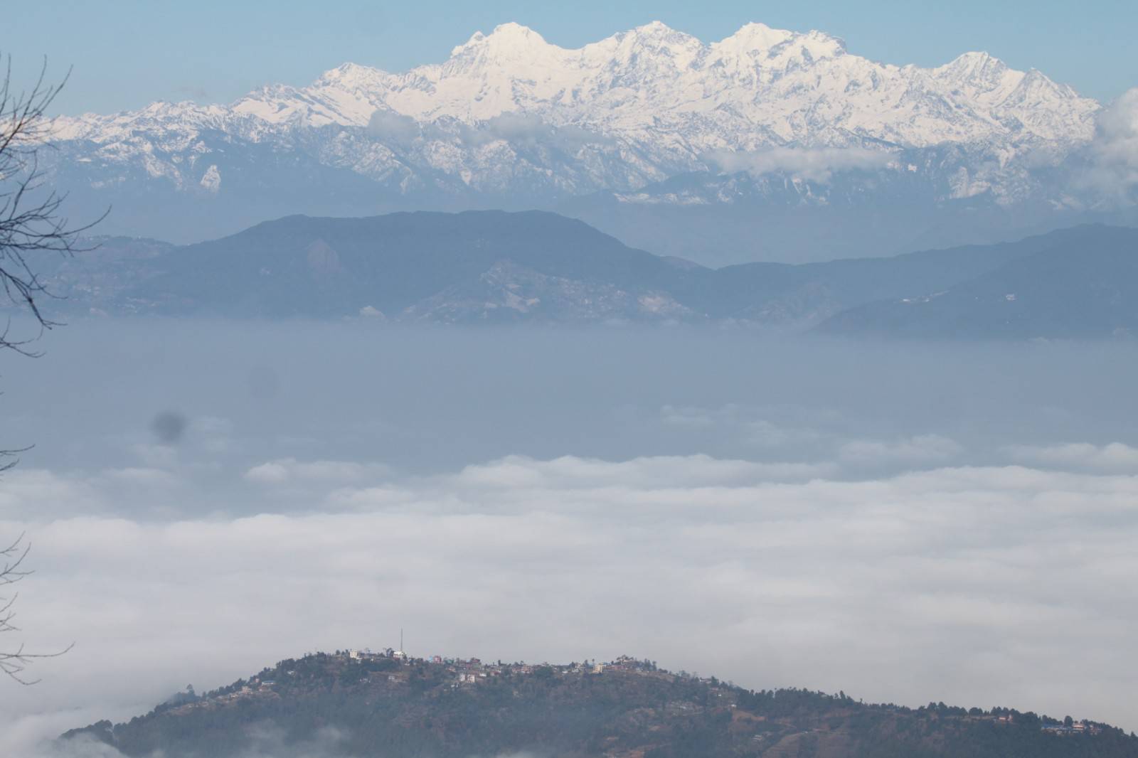
Our trek begins with one hour bus ride from Kathmandu to Panauti, a small town rich in Newari culture. We will sightseeing temples and courtyard, visit a local museum and enjoy Newari food and hospitality. After lunch we carry our backpacks and head for Namobuddha. The trek takes almost 3 hours to reach to the top of Namo Buddha (1 672 m) and involves walking through under pitched road. Namo Buddha is one of the holiest shrines for Buddhists where it is believed that a prince sacrificed himself to five hungry tiger cubs and was later reborn as Shakya Buddha in Lumbini. Today along with the shrine dedicated to the prince, you can also visit a newly but vibrant monastery and enjoy the picturesque views of Panauti and maybe Kathmandu from atop the hill of Namo Buddha. Ganesh Himal, Langtang, Guari Shankar, Dorji Lakpa are some of Himalayan ranges visible from the top.
Panauti:
Panauti is an ancient city rich in Newari culture and history and full of festivals. A proposed world heritage site the city is believed to have been founded around 1082 A.D. and built on a single rock. The temples and courtyards are made of terracotta and the oldest dates back to as far as 13th century A.D. The city lies in Kavre district and is 32 km south east of Kathmandu. Makar Mela which occurs during Jan-Feb is one of the most popular festivals of Panauti. It is a month long fair when devotees flock the Triveni (confluence of three rivers) to offer their prayers to god and take bath to cleanse themselves. Besides hotels and guest houses Panauti now also offers home stay facilities for tourists. Namo Buddha which lies east of Panauti is just 1.30 hour walk from here.
Namo Buddha:
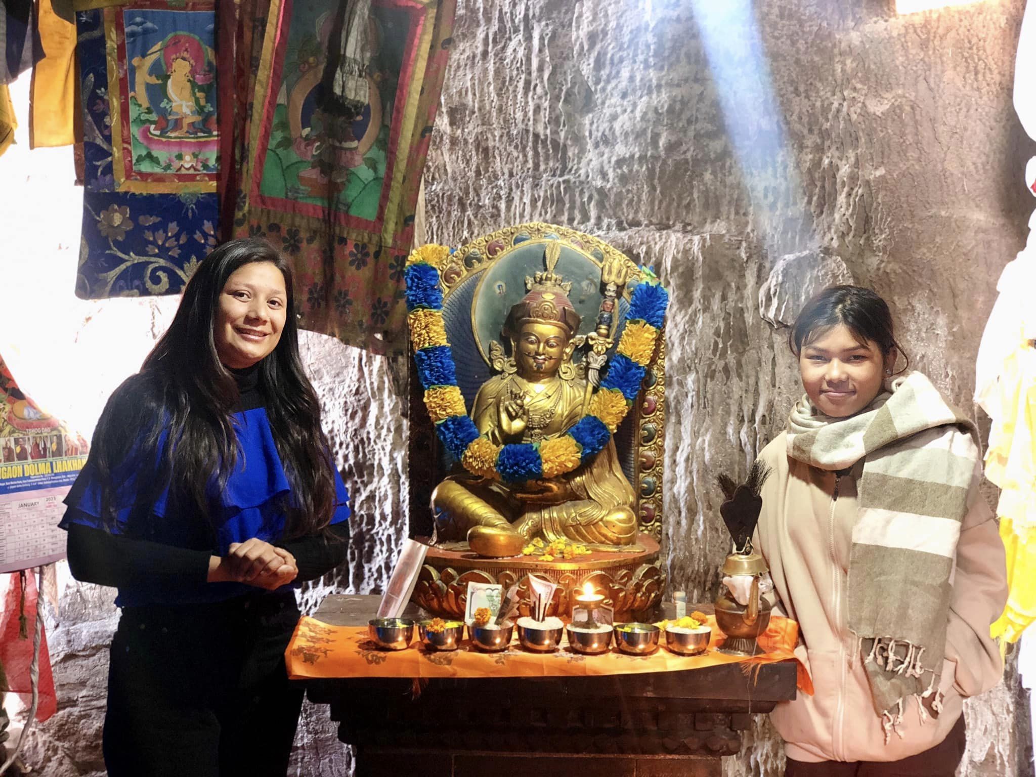
Namo Buddha is fourth most important Buddhist sanctuary after Lumbini, Swomyambhu and Buddha in Nepal. Situated in Kavre district just 10 km east of Panauti, the stupa is believed to have been built on the bones and hair of a Prince Mahasattva who is believed to be the former reincarnation of Shakyamuni Buddha. Legend has it three sons of King Maharatha went for a walk in the forest when they saw a tigress who had just given birth to five cubs. For lack of food the cubs were almost dying which was so emotional and heartrending that the youngest son Prince Mahasattva sacrificed himself to feed the cubs. On hearing their son’s greatness, king Maharatha is said to have build a Stupa in the name of his son. Namo Buddha basically means ‘homage to Buddha’. Pilgrims who come here offer their respects by lying down on the ground in reverence and hang pieces of their hair and cloth on the tree. Namo Buddha offers plenty of accommodation facilities including hotels and guest houses. Tourists can also opt to see monks’ life and enjoy living with them at Thrangu Tashi Yangtse Monastery recently built at the site. There is a stone engraving up the hill depicting the story of Prince Mahasattva which is believed to be the exact spot where he sacrificed himself.
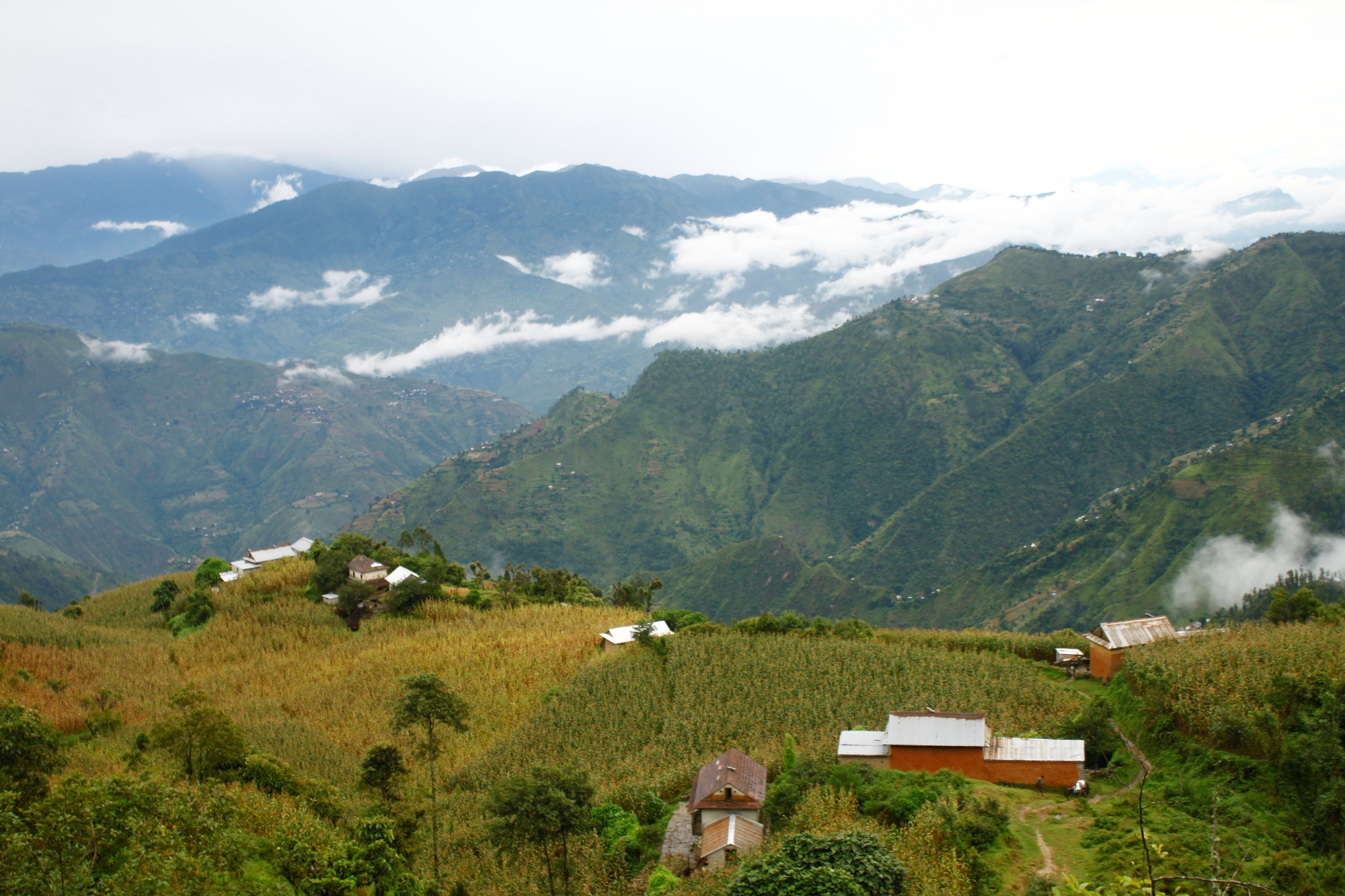
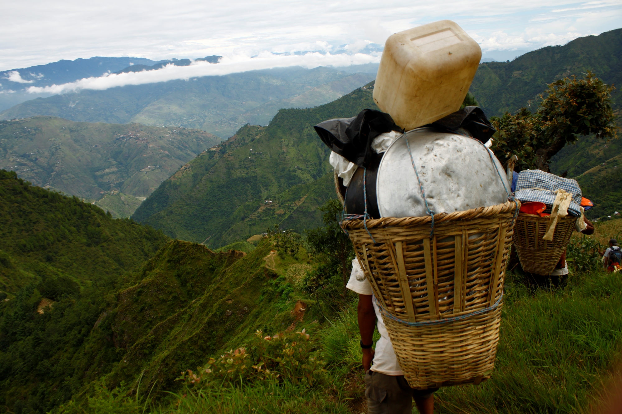
This ancient trail passes through small but serene settlements of various ethnic groups of Nepal including Tamangs, Bahun Chhetris and Newars. Much of the trail passes through under pitched road offering distant views of hills and distant Himalayas and features typical Nepali houses. The picturesque views of paddy fields and maize and farmers on the fields gives you a rural, nostalgic feeling of being back home. Important settlements along the way include Dapcha (1415m) and Shyam Patti (1649m). Patti or Inn in English means small sheds where travelers in old times used to put up for the night before continuing their journey the next day. Today these sheds have been left in shabby and unused state still reminding travelers of Nepal’s traditional way of life. This used to be old trade route for locals from east to bring their supplies such as rice and oil to Banepa take back salt. Along the way plants like nettle, salla, lapsi, bougainvellae and rhododendron can be observed. We will comfortably walk downhill partly through backwoods to Bhakunde Besi (1168m) for lunch. The trek approximately takes anywhere between 2.30 to 3hrs.
We will jump on a bus from Bhakunde Besi and climb uphill until we reach Khardar Patti. The stone inscription on wall of the patti mentions that it was built in honor of a Bhote man (middle hill man) in the year 1666 B.S. It is believed that the person who constructed this building had his hands chopped off by the Rana rulers at Hanuman Dhoka fearing his skills. The Patti is three floors high made out of wood and recently renovated with strut from Patan, consisting of carved windows and a small stone statue of a bull, believed to be the transport of Lord Shiva. Quickly we carry on our bus journey to our next destination for the night: Kot Timal. The narrow muddy roads, cutting bends and steep up hill.
Kot Timal
Kot Timal at an altitude of 1714m is predominantly settled by Tamangs with a slight mix of other ethnic groups of Bahun Chhetris and Magars. The Tamangs here are considered to be the descents of Rinzin Dorje. The Timal region which ocucpies much of Kavre District was once ruled by Tamang Kings. And Kot Timal is considered to be the seat of the then Tamang Kingdom and mostly referred to the famous King Rinchin Dorje. Lately there have been excavations carried out within the region to unearth the past stories and histories of former ruler and lifestyles and culture of Tamangs. Artifacts such as bricks, prongs, clayware, agricultural tools and implements, stones, and sickles have been found in the region including the spot where once stood the palace of Rinchin. Rinchin was regarded as one the 24 crown of across Nepal territory during the time of 22-24 statehoods. Kot Timal Durbar was regarded to be in between Rosi and Sunkosi Rivers.
It was after Prithivi Narayan Shah conquered Timal region that it was named Kot Timal. Prior to it Timal was a Buddhist state and strictly followed Buddhist culture not excluding avoiding meat. The word ‘Kot’ which refers to killing in Nepali language was added to the name Timal to officially declare it a cattle killing and meat eating region.
Once you are in Timal region, enjoy and embrace Tamang tradition and hospitality. You will be welcomed with Khadas (silk scarf), brimless flat hat of Tamangs, special coat made of local cotton and wang or local liquor. In fact Kot Timal is regarded as the birthplace of Tamang people. Timal was originally called ‘Teermaal’ meaning a place of prosperity and luck, a place where true dharma existed and a sacred place.
Buddha Chitta mala or special beads worn by Buddhist followers are special and unique contribution of Timal region to Buddhism. It is believed that this special beads used for prayers only grows in Kot Timal region and not anywhere else. Efforts at doing the same in other place have shown that though trees do grow they fail to bear any fruits. The locals take pride in the fact that Buddha Chitta is the product of Kot Timal and so almost every house has one or more trees. The significance of this has spread internationally thus giving boost to local economy. The story has it that when Guru Rimpoche asked his cook to leave Tibet and go back to his place in Kavre the latter refused to do. So Guru Rimpoche himself accompanied his cook back and while he was thirsty on the way he dabbed his knife on the ground and a spring of water sprang up. But as he did that his beads fell on the ground which he never picked up. Hence Kot Timal became the only place where the beads could grow.
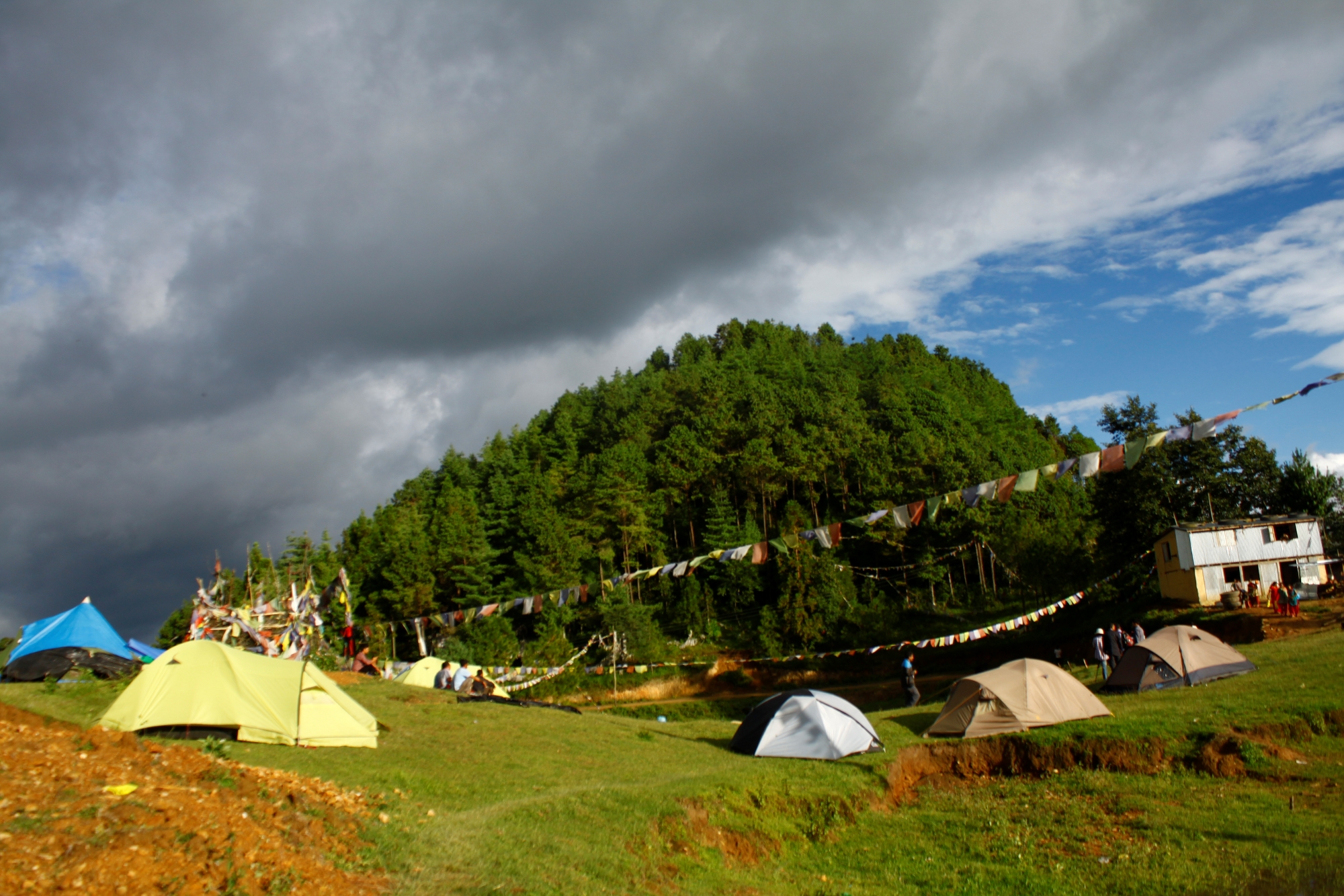
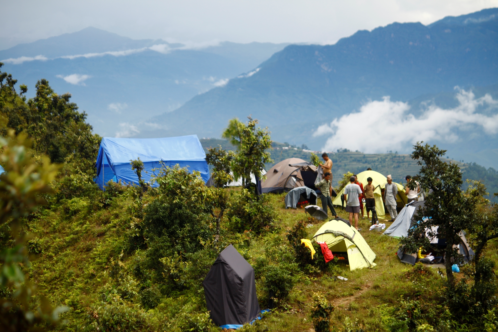
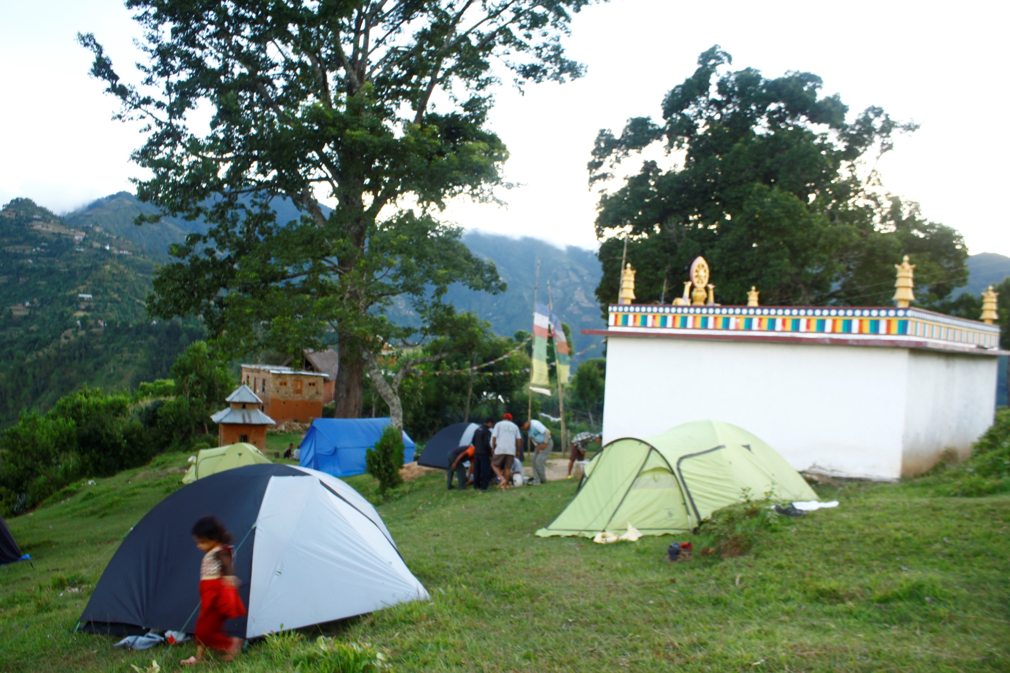
Camping at Kot Timal
Being atop a hill there a few open spaces available for camping- one of them is situated 200m south from Kot Timal chowk. From here one can view an obstructed and a most panoramic view of the Himalayan ranges including Annapurna, Manaslu, Ganesh Himal, Langtang, Dhaluagiri, Gauri Shankar to Rolwaling spanning almost 360 degree. Visible also is the wide view of hills, ridges, rivers to the farthest corner your eyes can reach. There used to be a pond right in the middle of the field but is said to have dried up because of the years of drought.
Another camping ground is located north of the chowk, 45 minutes walk. The site offers equally splendid views of the valleys and hills across. There is a new home stay being constructed nearby this site under local investment. Possibilities exist for tourists to choose to do rafting from Sukute to Timal Danda and then trek further from here.
Activities in Kot Timal
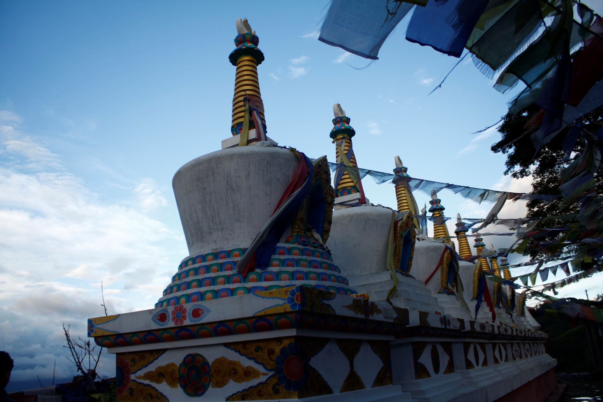
There are many things to explore while in Kot Timal. One could actually extend their trek by spending a whole day here in Kot Timal. Visit local ghyangs or chortens (Buddhist stupas) which are important sites of spiritual reverence for local populace. Two white chortens right in front of the chowk were made as early as 1991 B.S. One of the attractions of this place are the small ruins left of the kingdom of King Rinching Dorje. Locals are slowly taking initiative to develop this site for local heritage as well as tourism. It will take 30 minutes walk from the Chowk to visit the site, now adorned according to Buddhist rituals, where Rincihin’s palace was. Sadly almost everything was destroyed by the conquerors. Visit the Rinchin memorial site cum museum being constructed at main chowk to see the rare artefacts and historical documents discovered recently that dates back to the time of Rinchin. Currently Gyalbo Renzin Dorje Pratisthan is looking after the preservation and promotion of Renzing and Tamang heritage in the area. The department of archaeology is yet to continue exploration and excavation in the area.
We will wake up early the next day and have our breakfast by 6:30. This day begins with the exploration of the three most important religious sites dedicated to Guru Rimpoche or Padmasambava, the famous Buddhist scholar and rimpoche. Guru Rimpoche or Padmasambava: The lifestory of Guru Rimpoche has been detailed in Choi or Buddhist sacred scripture. He is said to have been born out of dirty lotus.
Situated at Yangbel Danda (hilly ridge), Gyelung Wu (1814m) and Tongsum Kunda (1931m) are the first two significant places where Guru Rimpoche is believed to have spent years meditating before he migrated to Halesi and after that to Tibet. He came to Gyelung to meditate after he departed from Pharping. These ancient caves, also mentioned in Buddhist Holy Scriptures, have been carved out into rocks and have only been discovered of recent. The walk to Gyelung Wu is pretty much downhill across east face of Yanbel hill along steep trails that become slippery and dense with undergrowth during rainy season. Locals have constructed cemented stairs on the final stretch of the Gyelung Wu thus making it much easier. The inside of the cave is physically less accessible and is barely tall and wide enough to allow a person to walk in. The cave has been lit up with a bulb which makes it easier for one to study the various religious images that have been carved on the walls inside including that of elephant, Bajra, drum, shell, sacred text etc. Crawling through an opening above will ultimately lead you to the top of the hill. Adjacent to this cave is an enclave where Lamas from different monasteries from across Nepal come here to meditate in silence and peace. Visitors should be utmost careful not to disturb the silence and tranquility of this sacred site. Another important part of Gyelung Wu is the stone sculpture of the right calf of Guru Rimpoche safely preserved on the wall. Visitors from as far as Tibet and Buddhists from all over Nepal come here to pay their respects.
The walk from Gyelung Wu and Tongsum Kunda is a bit challenging as we continue to walk down steep trails. On our way we will stop by the first Kunda (small pool of water fed by natural stream) where Guru Rimpoche is said to have drawn water from during his stay. According to local belief, when Guru became thirsty, he is said to have pierced with his stick through tantric power and thus sprang a spring of water. A further up we will reach Tongsum, where local lamas could be seen paying respect by lighting butter lamps. This cave consists of scultpures of Guru Rimpoche and other deities placed in an altar raised against the backdrop of the roots of a tree. There is a small water pool from behind this altar, perhaps the results of the seeping of water all year long through the walls of the cave. Guru Rimpoche is said to have also mediated here.
From Tongsum it takes around 1.30 hrs to reach Narayanthan (1912m). The trail is a regular route used by locals and presently opens up into a motorable road. All modern transport ply this muddy road that directly connects Kavre with Kathmandu. There is a sizeable market area here, equipped with schools, health clinic, very simple lodges, and government and private offices. A big ground exists on the base of Narayanthan Temple where stupas dedicated to Namo Buddha, Bouddha and Swoyambhunath have been built. A well built cobble stone staircase from here leads you to Narayanthan Temple (1912m), the most pious and auspicious religious mounument in the entire Kavre Timal region. The temple principally consists of scultpures of Lord Bishnu as well as Guru Rimpoche, with well built rest houses surrounded by community forest. The trees around the temple, locals say, never stand straight but rather are bend towards Rosi River. It is believed that God Narayan used to speak in old time.According to local belief, King of Kathmandu once ordered porters to carry Narayan to his palace at any cost. On their way back the porters settled exactly where the temple is today for a night’s rest. The next morning Narayan told them that he liked the place and refused to go and since porters could not dare to return empty handed lest the King became angry, Narayan agreed to allow porters to cut his nose, left arm and the toes of his right feet and to hand them over to the King. Narayanthan Temple in Kathmandu is said to have been built afterwards using the same organs. Every year during the full moon of August, a huge festival takes place dedicated to God Narayan. Majority of Tamang and other ethnic groups gather in the Temple from Kavre and surrounding districtss to pay respect to the God and fulfill their wishes. They make noses out of cow curds or ghee and make wishes. Jhankris, predominantly of Tamang origin, will be an interesting sight to watch as they perform their rare dances and rituals and offer their ultimate respect to Narayan. Both men and women Jhankris clad in their traditional dress, beat their drums while some enter into a trance as they show off their power and skills.
Jhankris or Shamans:
Our next destination is Yari Nag, just 20 minutes walk from Narayanthan. Yari Nag (1876m) is the third most important sacred site of Guru Rimpoche in Kavre Timal region. According to Buddhist scripture, this spot has been recognized as the place where Guru Rimpoche, after meditating in Geylung and Tomsung, fought a battle with the demon called Yaksha Nagbo or black demon before killing him in Bilimbra cliff nearby. The place where He struck the devil into the ground is today represented by a deep crater. Recently a big statue of the great Rimpoche have been raised here. Next to this is a shallow ground where once locals believe there was a pond and there lived a nag or Cobra. The pond is said to have dried up after the nag left the water. This is a perfect place to have our lunch and rest for a while.
Afterwards we will head towards Chapakhori (1755m), our camping place for the night. The 1.30 hour trek traverses the main road that has been recently laid out. Along the way don’t miss out to observe small pool of water a few meters away from the road, considered to be the naval of Sun Kosi River. The water in the pool never dries up and is unusually very deep. There is a local school nearby the camping ground. Local’s enthusiastically gather here in Chapakhori to observe Red Berry Festival or Chuthra Jatra, during April full moon when red berries grow all over turning the whole area into one color.
Our next day begins with a hot cup of tea and by evening we will have made a considerable drop in altitude and reach SidhuPalchok District. From Chapakhuri it is a walk through picturesque villages dotted with small markets and rows of wooden houses settled mostly by newars and Tamangs. Buses going to Kathmandu usually pass through this route and the village is vibrant with economic activities such as milk production, education and development projects. Bhote Patti, another rest inn for weary travelers, is a constant reminder of how the names of the places evolved over the years when Bhote communities like Tamangs were displaced by other communities.
Enjoy the green farms and taste local food based on the season you are visiting like apple, pineapple, banana, cucumber, corn, green vegetables, all grown organically. Almost a 30 minute walk through backwoods will drop you down to Mecche Pauwa. Mhe Jey which in Tamang language meant the footprint of cow, there in fact is a small stone embedded with the footprint of what locals believe is that of a holy cow who fled in the event of impending hot temperature. Mecche Pauwa is a small settlement with few shops, a school and modest eating places. The trek past this village is exciting and more scenic as it offers a close up and personal view of Mahabharat range.There is a steep descent from Meche along a sharp ridge overlooking the conflaguration of three districts namely, Kavre, Ramechap and Sindhuli. As Rosi joins Sunkosi River, a wide valley of Sunkosi opens up, a meeting point for three districts. We will stop by Titer Tar (612m) to have lunch. Titer Tar is the final frontier of Kavre Timal and Kavre district on this side of Sunkosi. It takes almost 2.30 hrs to reach Tekanpur village.
Following a good hour’s rest after lunch, we continue our journey for our day’s camp. Nepal Thok is just 2 hours steep descent through pebble and stone strewn trail from Tekanpur and involves crossing Rosi river. Nepal Thok sits at the meeting point between Rosi and Sunkosi and officially lies in Sindhuli District. In fact the weather becomes a bit hot compared to the hills of Kavre.
Mahadevsthan lies on the banks of Sun Kosi River and is a holiest shrine for Hindus dedicated in the name of first Adhi Linga. The site, according to Hindu Mythology, was created by Bramha, one of the three supreme lords, during his meditation. Today the place is a reverential site among Hindus and especially Shiva followers and is also used for funeral ceremonies. The temple acts as a shelter inn for worshippers and sadhus alike. Just across the Sunkoshi high among the hills is a Balmiki Cave where Balmiki is believed to have spent time meditating.
Early morning we jump on a bus and head towards Sindhuli Gadi, around 70 Km south of Nepal Thok. There are small transport like jeeps and cars also available on hire at nearby bazar. We travel on BP Highway which connects Sindhuli District with Bhaktapur. A few sections at different points along the Highway are still under construction thus expecting a rough ride through dirt and gravel road and diversions. The track passes through some of the best road sections as we gradually gain altitude. Motors can easily make their way up to the top of Gadi. The Gadhi offers wide ranging views of the Himalayas and Terai plains as far as Janakpur.
Sindhuli Gadi
Sindhuli Gadi which mean Fort of Sindhuli is well known fort in Nepal. It was the Fort where Nepalese Gurkhas fought their first ever battle with the British. History has it that Gurkhali forces under the leadership of King Prithivi Narayan Shah were fast overpowering the rulers of Kathmandu Valley. They had already won Makwanpur, Nuwakot and Timal region. The king of Kathmandu, Jaya Prakash Malla had asked for help with the British in fear of the advancing Gurkhalis. It was here in Sindhuli Gadi that the British under the command of Captain Octerlony attacked the Gurkhas. At that time the Fort was defended strongly and with valiant and determination by Magars, one of the four ethnic groups that made up Gorkha forces. Story has it that Gurkha forces had nothing to guard themselves with but stones. British forces on the other hand were already having difficulty wading through nettle bushes that grew all along the hills. The Gurkhas used a shrewd tactics of covering all the bee nests with white cloth and hid themsele. Unaware of where the Nepalese force went hiding the British fired at the curious white cloth hanging from the trees mistaking them for hiding place. As the swarms of bees went into offensive this so much terrified the British that consequently they gave up the fight and leaving their cannons behind.
Although not much except the fort itself remains for visitors to cherish. Actually there are two forts which are distanced some 100 meters from one another. These forts have been preserved by local communities with most of the ruins left in its original condition. Impressive features of these forts are the views it offers from the top including the entire view of Terai in the south and hills in the north. One could still canon holes, deep tube well, stair cases in the fort. There is also a temple dedicated to Gadi Mai engraved out of a cave near the old Fort where worshippers come to fulfill their wishes.
Another interesting site to visit is the Sindhuli Durbar or Palace itself. The palace is now in a dilapidated state with most of its structure absent. However one could still see windows, walls and intricate carvings therein. The palace and Gadi are covered by thick bushes and shrubs during the winter and surrounded by dense forests. Historical artifacts and stone scrimptions discovered within the site and dating back to that period are well preserved and free to observe for visitors. Sindhuli Gadi Preservation and Promotion Committee is actively pursuing to develop the area into a touristic destination. The area is settled by Magars, Gurungs, Bahun and Chhetris. Nowadays people from nearby places come here for travelling and picnic. Cattle rearing and vegetable farming are developed simultaneously to aid tourism development in the area. Do try out some local cuisines including fruits and liquor made out of citrus food. After this day treat, we head back to NepalThok on the same road. By evening we will be ensconced in the comfort of our camp.
The trek from Nepal Thok to Shikarpur is a moderate one. The trail passes through villages and steeply gains a height of over 1000m, as we climb hills through village routes. Most of the residents in this area are Tamangs and Magars who live on subsistence farming with maize, wheat and potatoes being the main staple diet. Banana, orange, amala, junar and guava are fruits normally grown in this area. Don’t forget to try Dhido, a special dish made out of either maze or wheat and eaten instead of rice, with Sukuti, dried meat, and spinach. Liquor made up of rice, maize and wheat are a special treat and form the tastiest delicaies around here.
The trek consists of more uphill climbs. We will stop by at Khani Gaon for lunch, a village characteristics for rural lifestyle and Ghyangs or stupas made in the name of dead relatives and Lamas. The scenic pictures of villagers ploughing their fields, harvesting, and doing their daily chores such as milking buffaloes, gathering fodder for goats are such peaceful sights to observe.
Many of the settlements around here use biogas for cooking and solar for lighting. It takes almost 6 hours walk from Nepal Thok to Shikarpur. Shikharpur is a tiny settlement most of Bishwo Karmas and Tamang people.
Next stop ahead of Shikarpur is Gyangdanda in Bhim Khuri VDC, again a Tamang and Bishwokarma, Bhujel settlement, who live here side by side. Local hospitality of Tikas and blessings awaits you at Gyangdanda, which was named after an old Gumba. There are slighly over 20 houses in Bhimkhuri, majority of whom belong to Tamangs. From Gyang Danda it is a rapid ascent towards Naya Sola. Nag Daha, or a lake of Cobras, which has now dried up, and hunter god who used to come ringing bells is two local myths worth listening to. Enroute we come across a green meadows called Purano Sola, which was used as a place to punish people or trap travelers. Further up there is another spot called Naya Sola that was named during Rana rule. Naya Sola at 2113m is gearing up to construct a view tower to offer tourists and visitors as the place high on the hill offers a perfect viewpoint to watch Gauris Shankar and Ganesh Himal ranges and Lalbandhi, Sindhuli and Bardibas in southern plains. The area is rich in herbal plants such as Satuwa, Siraito, Jatamasi, Saduwa, Pakhanbel and so forth. There is a road recently built that connects the village all the way to Sindhuli Madi in Sindhuli District.
We then descend to Juge Pani (1809m) for lunch. Juge Pani has a well running cheese factory that produces cheese and paneer among other things. A recent project to run biogas in the area failed. The place was named after a sadhu called Jogeshwar, who held such a high dignity. Another story is of existence of Juga or leeches in Pani or water and hence the name. Katarche Danda at 1865m is almost 1.30 hour walk from Juge Pani. Katarche Danda offers one of the most spectacular views of the Himalayas from Ganesh Himal and Manaslu to Langatang, from Gauri Shankar and Everest to peaks in Tibet. What makes it so special is that it is still an unexplored area lying outside of the normal trekking route. Wildlife such as parrots, mayur, porcupine, deer, rabbit and even tigers have been sighted.
After early breakfast we get ready to climb Godechuli Danda, a major attraction of the trek. Further 2 hours walk from Katarche Danda could reach you up to Gode Chuli Danda, one of the highest spots in the Mahabharat range. The trail is a bit risky even during autumn season because of uncharted trail sections, slippery shrubs, dense forests and no signage. Even locals used it very rarely. However the labor up to the top is worth the views that it offers. The southern plains as far as Sarlahi in the South and the Himalayan panorama on a clear day could be easily captured. Locals even believe of seeing Dharahara of Kathmandu.
Legend has it that the war of the epic Mahabharat took place in this Mahabharat ranges and hence the name. Legend has it that during a showoff of stamina between Hanuman and Bhimsen, there was a challenge between them to lift 80 man kilo. Bhimsen failed to life while Hanuman succeeded. Another legend has that this is where Bhimsen while riding off his horse stepped on the Mechey village and pressed his knees in Godechuli Danda before finally taking off to Dolkha.
Godhechuli is famous for Godhaure Festival that takes place every 12 years at nearby Chaitepani area. It is also popular for Godhaure Flower that blooms every 12 years and equally for rhododendrons that flower every autumn in abundance. Wildlife such as foxes, boar, porcupines, deer and even tigers are believed to exist in the forest. Godechuli is believed to be the sacred altar for Bhume God. Locals pay their due respect to Godechuli to avoid any attack or mishaps that could be inflicted by wild tigers. Locals confide seeing of green rainbow big enough to over the cloud above the Ghode Chuli
Pauwa at 1556m is relatively developed unit in this area with facilities like schools and health clinic. We will pass through villages of Badaure (1497m) and Manigaun (1417m) before finally rounding off our camp at Deurali Danda at 1421m. All of these villages have Tamang people as majority of settlers along Bishwo Karma, magar, newar among others.
Deurali Danda in Bhimkhori village in particular is a mixed settlement of Tamangs and Raimajhi Chhetris. At Deurali Danda there is Tashi Tharbe Ling Gompa recently built however its foundation was built some 200 years ago. Story has that the then Rana Prime Minister Chandra Shumshere was very happy when a Lama from the area treated his mother of her illness and in return the PM laid foundation for the construction of Gompa. The Lamas had offered prayers to Taradevi Dolma to relieve the pain of queen mother. Bhikhori is the spot where five Pandav brothers spent some time during their 12 years forest banishment. It is from here that when chased by Kaurav, the Pandav brothers bore a tunnel underneath and went into the refuge of Birta King in Biratnagar. Mahabharat is also the grazing ground for the cows of King of Birat.
It takes just about 2 hours rapid descent from Deural Danda to reach Kalo Dunga near the highway. The trek passes through Thumke Danda with sparse Tamang settlements. From here we trace our way back to Bhakundebesi and back to Kathmandu via Dhulikhel.
We will have farewell dinner at Garden of Dream. We also exchange our photographs, video and all the experiences that we conquered.
We drove you to Tribhuvan International Airport and last goodbye. We hope you enjoyed in Nepal.
Trip Format
The Great Buddhist Master’s Trail & Mahabharat Trek is one of the nearest treks from Kathmandu. It is a rare combination of Mahabharat range, culture of mainly Tamang and other ethnic groups and Newari architecture. The trek is easy to moderate. Trekking trails are occasionally met by under construction link road but the area is full of unique features such as Shamans, historical Buddhist monasteries, Godhechuli hill, eighth century Buddhist Master Guru Rempoche’s meditation caves, and of course one of the longest panoramic view points that stands stop the hills of both Timal region and Mahabharat range which all make it a unique Himalayan trek.
Included in the Cost
All the accommodations during in the tour Special Guru puja and needed materials All the trekking crew including local guide, porters and trasportrations All their salar, food and travel insurance etc.
Not Included in the Cost
International Flight Travel insurance Any personal expenses Tiping to trekking team
| Start date | End date | Price | Status | Book |
|---|
Map
Related Tours
Footsteps of Guru Rinpoche
Four Hills Of Kathmandu
Pilgrimage Tour Nepal
Vajra Yogini Pilgrimage Tour
Everest Helicopter Sightseeing

Tiji Festival Photography Tour 2027
Gokyo Ri and Buddhist Masters Trail
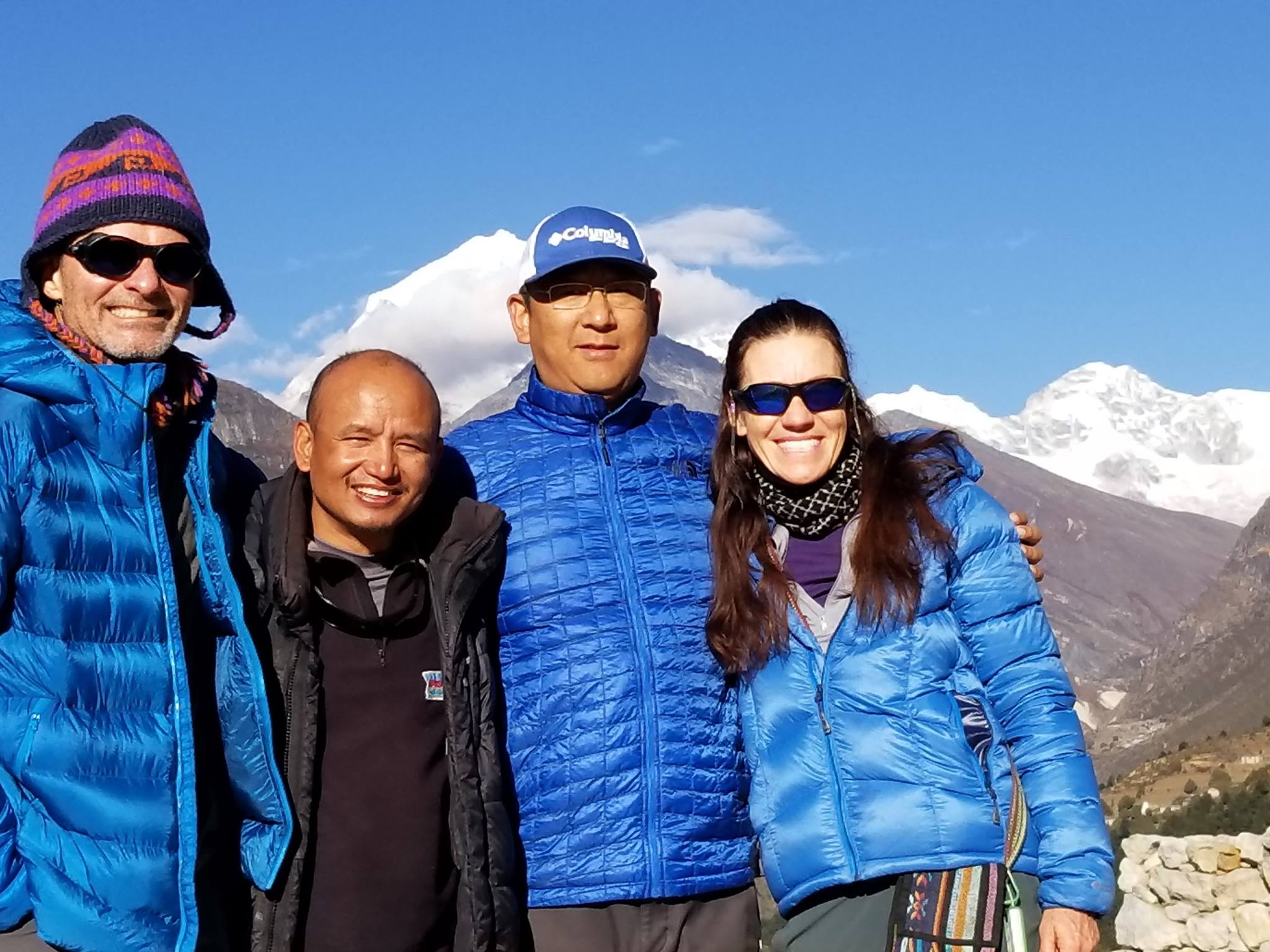
Rakchya, our guide on the Gokyo portion of our trek, arranged everything including changing our itinerary for weather delays and managing our flights to and from Lukla. He knew all the tea house owners, greatly enhancing our stays.
Dawa led us on the Buddhist Master Trail and has in-depth knowledge of the cultural highlights, Buddhist pilgrimage sites, and wonderful stories for each of the sites – and finished our trip with lunch at a great dahl bhat shop!
I would highly recommend arranging your trip and traveling with Traveltimes Treks. They are knowledgeable and helpful and will happily work with you to provide the experience you are looking for.