Upper Dolpo Camping Trek
Tour Details
At the edge of the Tibetan Plateau in the great Himalayan rain-shadow lies Dolpo, the legendary, Ba-Yul or “Hidden Land” – historically cut off from the rest of the world by a barrier of high mountains, deep gorges and thick forests. Nepal’s Dolpo region is legendary among loves of Himalayan culture and landscape. Few foreigners have been allowed into this pristine enclave inhabited by some of Asia’s most culturally intact Buddhists. Dolpo was opened to trekking in 1990 and Shey Gompa only in 1992, and the number of foreigners allowed in the region remains strictly limited by the government of Nepal.
Among the visitors to Dolpo are two extraordinarily sensitive and talented writers: David Snellgrove, who visited the region in 1956 and wrote Himalayan Pilgrimage about his explorations, and Peter Matthiessen, whose The Snow Leopard is one of the classics of Himalayan literature. These books describe a land of magnificent quietude and beauty. “How peaceful is Dolpo,” Snellgrove wrote, “not only its mountains, but also the lives of the men who live there.”
“I wait facing the north; instinct tells me to stand absolutely still. Cloud, mist, snow and utter silence, utter solitude: extinction. Then, in the great hush, the clouds draw apart, revealing the vast Dhaulagiri snowfields. I breathe, mists swirl, and all has vanished nothing! I make a small involuntary bow.”
Peter Matthiessen on crossing the Phagune Danda enroute to Dolpo, from The Snow Leopard.
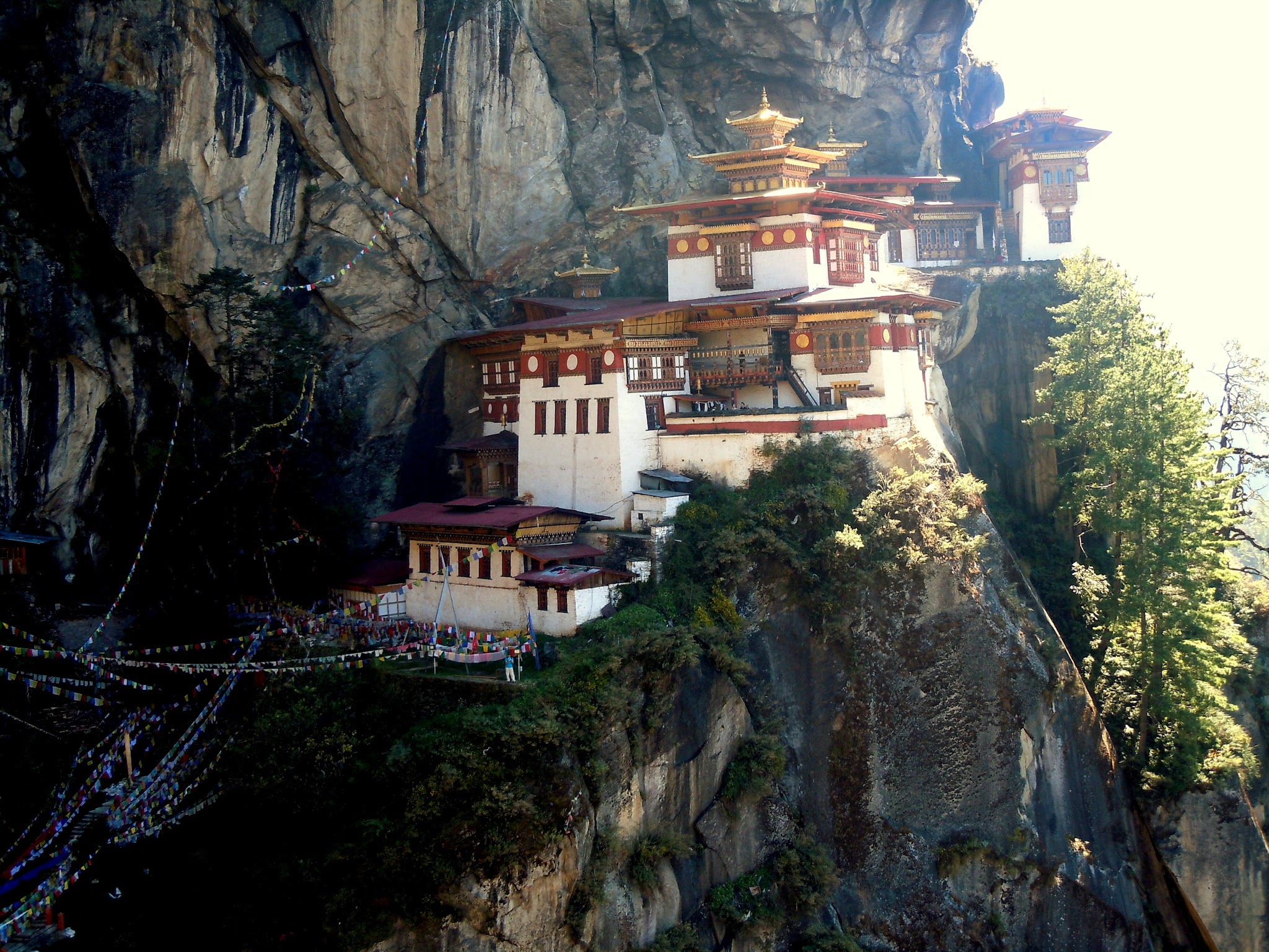
Our 29 day trek will begin at Baglung near Pokhara, amidst Nepal’s brilliant green rice terraces. We will walk near Annapurna and beneath the giants of the Dhaulagiri Range. Our route winds westward through villages which have seen few trekkers, through the spine of the Dhaulagiri Range, and over the 4 400 m high Jangla pass and then north toward the remote Kanjiroba Himal. The hiking is not technical, but there is a lot of it! In Dolpo we will journey into the exceptionally isolated area of Tarap in Shey Phoksumdo National Park, then north to Shey Gompa, The Crystal Monastery, and south to the exquisite Phoksumdo Lake. Home to snow leopard, blue sheep, lammergeier, and one of the few enclaves of unoppressed traditional Tibetan culture, this is authentic, rugged, unspoiled, and unforgettable arguably the best trek in all of Nepal.
Short Itenary
Day 01: Arrival in Kathmandu
Day 02: Sightseeing in Kathmandu Valley
Day 03: Busdrive Baglung
Day 04: Trek Singa (2 840 m)
Day 05: Trek Darbang (3 520 m)
Day 06: Trek Sibang (1 650 m)
Day 07: Trek Lumsum (2 160 m)
Day 08: Trek Jaljala (3 300 m)
Day 09: Trek Dhorpatan (2 874 m)
Day 10: Trek Thankur (3 240 m)
Day 11: Trek Pelma (2 940 m)
Day 12: Trek Dhule (3 276 m)
Day 13: Trek Seng Khola (3 840 m)
Day 14: Trek Phubung (3 930 m)
Day 15: Trek Sahartara (2 730 m)
Day 16: Trek Bheri River (2 100 m)
Day 17: Trek Lahini (3 120 m)
Day 18: Trek Shipka (3 450 m)
Day 19: Trek Dho (3 878 m)
Day 20: Trek Kakar (4 230 m)
Day 21: Trek near Se La (5 294 m)
Day 22: Trek Stone House (4 410 m)
Day 23: Trek Shey Gompa (4 140 m)
Day 24: Rest day Shey Gompa (4 140 m)
Day 25: Trek campsite Tuk Kyakas (3 756 m)
Day 26: Trek Phoksumdo Lake (3 600 m)
Day 27: Restday Phoksumdo Lake (3 600 m)
Day 28: Trek Regi (2 670 m)
Day 29: Trek Chepka (2 580 m)
Day 30: Trek Dunai (2 070 m)
Day 31: Trek Jafal (2 610 m) & flight Pokhara
Day 32: Fly to Kathmandu
Day 33: Free in Kathmandu
Day 34: Fly out Kathmandu
Itinerary
Pick-up at Tribhuvan International Airport, meeting with your guide and transfer to the hotel. First impressions of Kathmandu (1 350 m) – walk to medieval Kathmandu Durbar Square and explore the beautiful complex of palaces, temples, shrines and courtyards built by the ancient Nepali kings between the 12th and 18th century. We bring you to our office and Thamel – the vibrant tourist area with hotels, restaurants, bakeries and outdoor shops. We get to know each other over a welcome dinner, check formalities and equipment and discuss your itinerary.
Today we discover the highlights of Katmandu and the valley. We adapt the programm to your interests and desires and what you have seen before. Usually, we go to Pasupatinath on the bank of the Bagmati River, where the most important Hindu temples and burning ghats of Nepal are situated. In Bouddhanath we circumambulate together with Tibetan and Nepali Buddhist pilgrims the whitewashed stupa. Our sightseeing usually ends in Patan, the city of Beauty, an astonishing center of fine art and Buddhist and Hindu culture.
Leaving Kathmandu to Beni by private bus, it takes approximately 8/9 hours bus drive. Our trek begins here in Baglung.
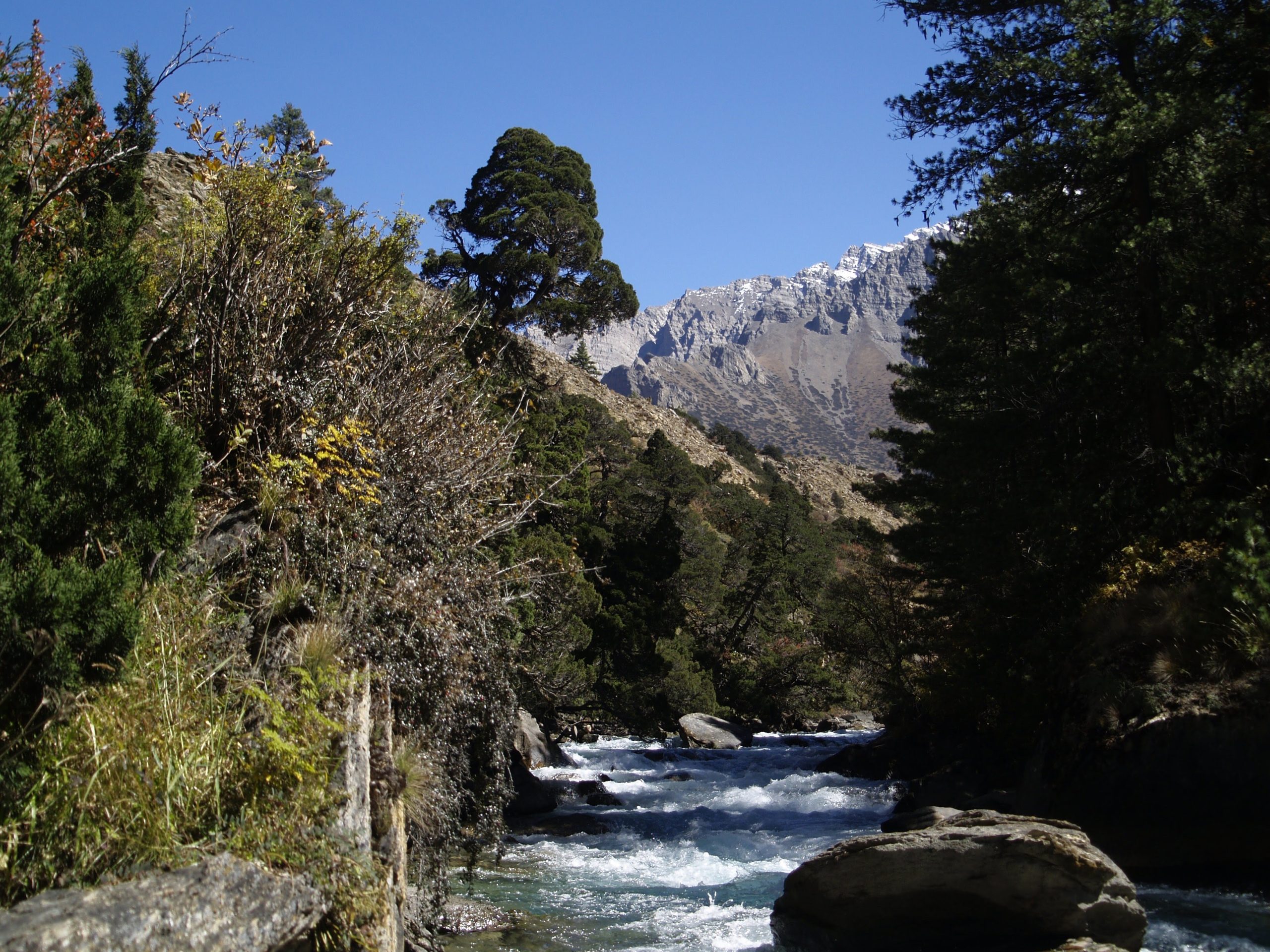
After several hours of relatively easy walking on the east bank of the Kali Gandaki river we arrive at the confluence of the Kali Gandaki and the Mayagdi Khola (the river rising from the western glaciers of the Dhaulagiri Massif and the route for expeditions to the north side of Dhaulagir I). Here we cross the Kali Gandaki and the Mayagdi to the village of Beni (3 200 m), the last large bazaar town until Dunai, near the end of the settlement Singa (2 800 m) where we camp.
Shortly we reach Tatopani (3 300 m) which has a hot spring. The trail continues up the Mayagdi past a washout on the north bank of the river before reaching out camp at Darbang (3 520 m). Here the Mayagdi changes course to form a “dog leg” flowing north to south. On the south side of the river across from Darbang there is an enormous landslide which occurred in 1988.
The trail crosses to the west bank of the river and there meets the Danga Khola. At Phedi the trail begins a very steep ascent through pine forests to the village of Dharapani (1 500 m). From near Dharapani we will have wonderful views of Dhaulagiri (8 043 m) and its gigantic satellite peaks; Dhaulagiri II (7 628 m), Dhaulagiri III (7 593m), Dhaulagiri IV (7 539 m) Dhaulagiri V (7 497 m), Dhaulagiri VI (6 996 m), Churen Himal (7 247 m), Putha Hiunchuli (7 125 m), and Gurja Himal (7 061 m). The trail, relatively level for Nepal, continues past the village of Takum to our camp at Sibang (1 650 m).
A relatively short easy day starts with a short climb to a spectacular viewpoint of the Dhaulagiri range and then proceeds with a gradual slight descent to the village of Muna. We cross the Dara Khola and climb steeply to our camp near the village of Lumsum (2 160 m) passing several spectacular waterfalls on the way.
The trail follows the stream and climbs past the hamlet of Moreni and continues a steep climb for several hours through a heavy jungle of rhododendron and oak up to the plateau of the Jaljala. The views from here are some of finest in Nepal. From west to east are Putha Hiunchuli, Churen Himal, Gurja Himal, Dhaulagiri I (8 043m), the Nilgiris, and far in the distance, Annapurna I, Annapurna South, Machhapuchhare, Bauda Himal, and Himalchuli. We will camp here so this view can be savored in both the evening and the morning. Camp on a wild grassy meadow at Jaljala (3 300m).
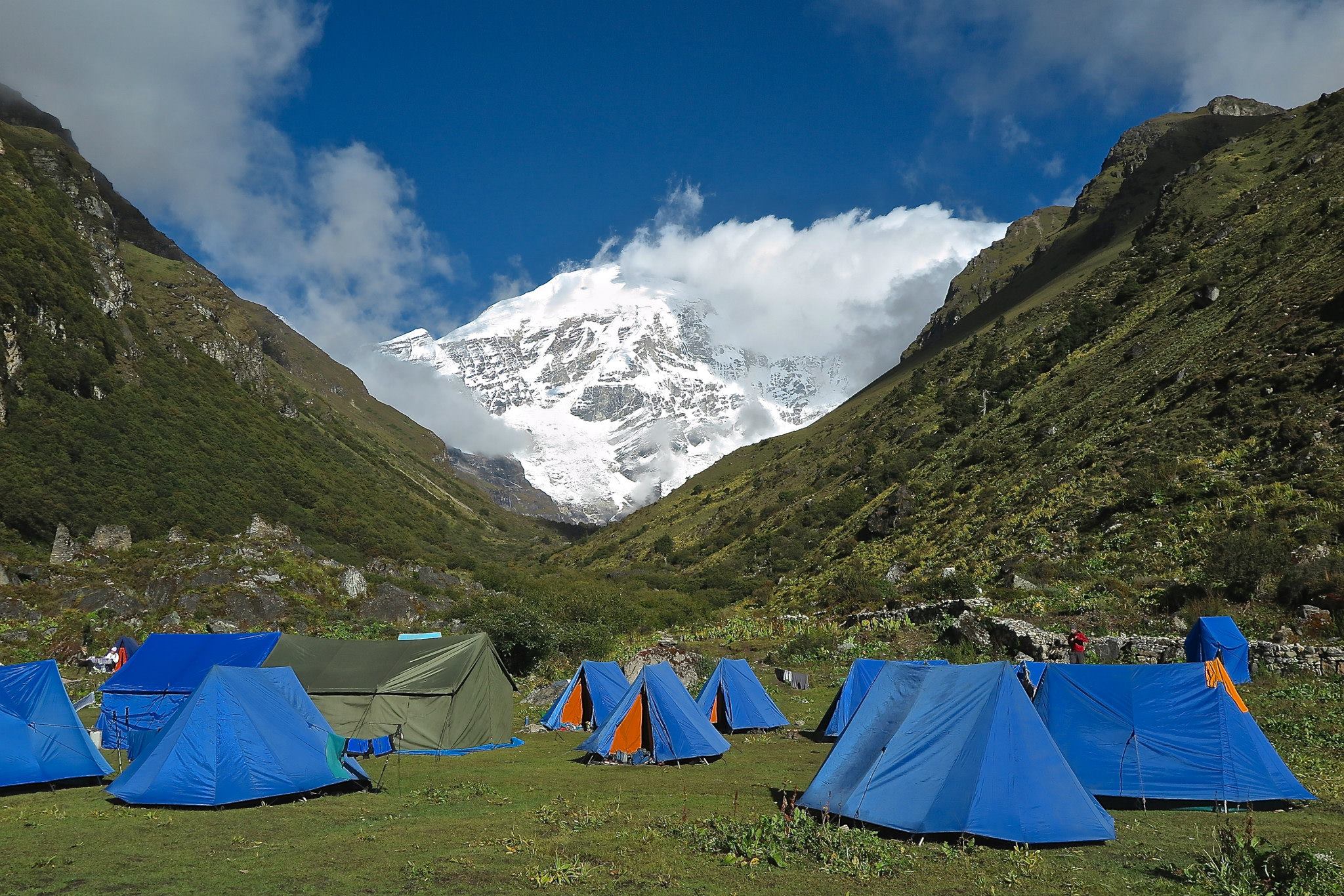
The trail descends gently to the headwaters of the Uttar (Northern) Ganga and follows meadows down through blue pine and black juniper to Gurjakot (2 970m). The trail crosses the Simudar and Gur Gad rivers which enter the Uttar Ganga from the north. A boggy area is passed near a gompa (monastery) of the Bon Po sect. Bon po is a pre-Buddhist faith reminiscent of shamanism-where every object is believed to have its own spirit. In the seventh century, when Buddhism came to this part of the world, the Bon priests incorporated it into their own religion to such an extent that the two became outwardly almost indistinguishable. Continuing on brings us to the Dhorpatan Valley and Chentung (2 880 m), the first permanent habitation since Moreni. This hamlet and the village to the west, Giraund (2 797m), are inhabited by Tibetan refugees who fled here in 1960 after the Tibetan revolt against the Chinese. The valley of Dhorpatan in unusually broad and flat, and many Nepalese from villages to the south farm and graze stock here during the summer. There is an airfield here for single engine aircraft but it is now seldom used. The broad, flat valley, unusual for Nepal, is surrounded by forested peaks between 3 600m and 3 900m. Camp at Dhorpatan (2 874m).
Leaving the Dhorpatan Valley, we will turn north entering country previously closed to foreigners. We climb through forest to huts and a small valley, where we may see groups of silver-gray langur monkeys, then up steep slopes to the Phagune Khola. The summit of the Phagune Danda can be seen high above. After lunch the trail steepens and we climb along the stream and up steep hillsides to the Phagune Danda 3 900 m), marked by a small chorten. This wild territory is the western extension of the great Dhaulagiri Massif: blue sheep and snow leopard country-sparsely populated terribly remote, and lavished with superb vies. From the Phagune Danda there are fine panoramas of Churen Himal and Putha Hiunchuli, and the feral country to the northeast. The descent contours down above wide sweeping meadows high above the headwaters of the Ghustang Khola. We come to a beautiful grassy saddle at 3 600 m about two hours below and after the pass. We then descend steeply through forest to reach the valley of the Ghustang Khola and open meadows to our pristine camp in a meadow known locally as Thankur (3 240m). This is a very long day.
The path continues downstream enters a fantastic virgin forest with hemlock, spruce and oak well over a hundred feet high. We follow the crashing rapids of the Ghustang Khola until reaching a bridge crossing the river. This is the habitat of the Himalayan Panda, leopard, bear and many birds. The trail now climbs steadily upwards from the river for about two hours before traversing near the summits of the Kyani Danda to a grassy ridge at 3 060m perched precipitously above the Ghustang Khola which rages in its forested gorge thousands of feet below. To the west is the depression of the great Bheri river complex. The track descends gently along the ridge before reaching a shoulder where we descend through fields to our camp at Pelma (2 490m), a village of Khamis (the blacksmith/carpenter caste), chettris (the martial casts), and Magars (a distinct tribe). These villagers speak Kham, a Tibeto-Burman language similar to the language spoken in the Tichurong villages of Dolpo. In the autumn the villagers here may be drying walnuts while storing colorful squashes and grains on top of their dwellings. Pelma is the first of the flat roof architecture that we begin to see from this point on.
We descend to the Pelma Khola at 2 130 m and climb to the Magar hamlet of Yamkhar. The trail continues steeply for about an hour before traversing to a shoulder and a panoramic view back to the Phagune Danda. The route descends the climbs through forest to a field known locally as Kyar Kharka(3 180 m). We continue in the forest and enter a grotto where a new trail climbs along the creek bed to our camp at the small Magar settlement of Dhule (3 276 m).
We now begin a 600m climb along the forested ridgeline before traversing upwards on the Dhule Deorali to the Nautala La (3 840 m). From this pass (where we have a vista of the country we have traversed from the Phagune Danda), the trails drops steeply into the Seng Khola gorge. We proceed up the Seng Khola for several hours and to our isolated campsite next to the river (360m).
Shortly we leave the Seng Khola and climb steeply on sweeping grassy slopes to a tiny marshy lake, the Phuphal Dah (360 m). This is a beautiful site, and there are good chances to see blue sheep. We climb to a cleft 150 m above Phuphal Dah where we begin to cut through the Dhaulagiri Range. From the cleft we can see the Jangla pass (which we will reach the next day). We descend through vast grassy slopes to the Saure Khola at 3 750m and cross the river (it may be necessary to wade). We climb to our camp on a bench known locally as Phubang (3 930m).
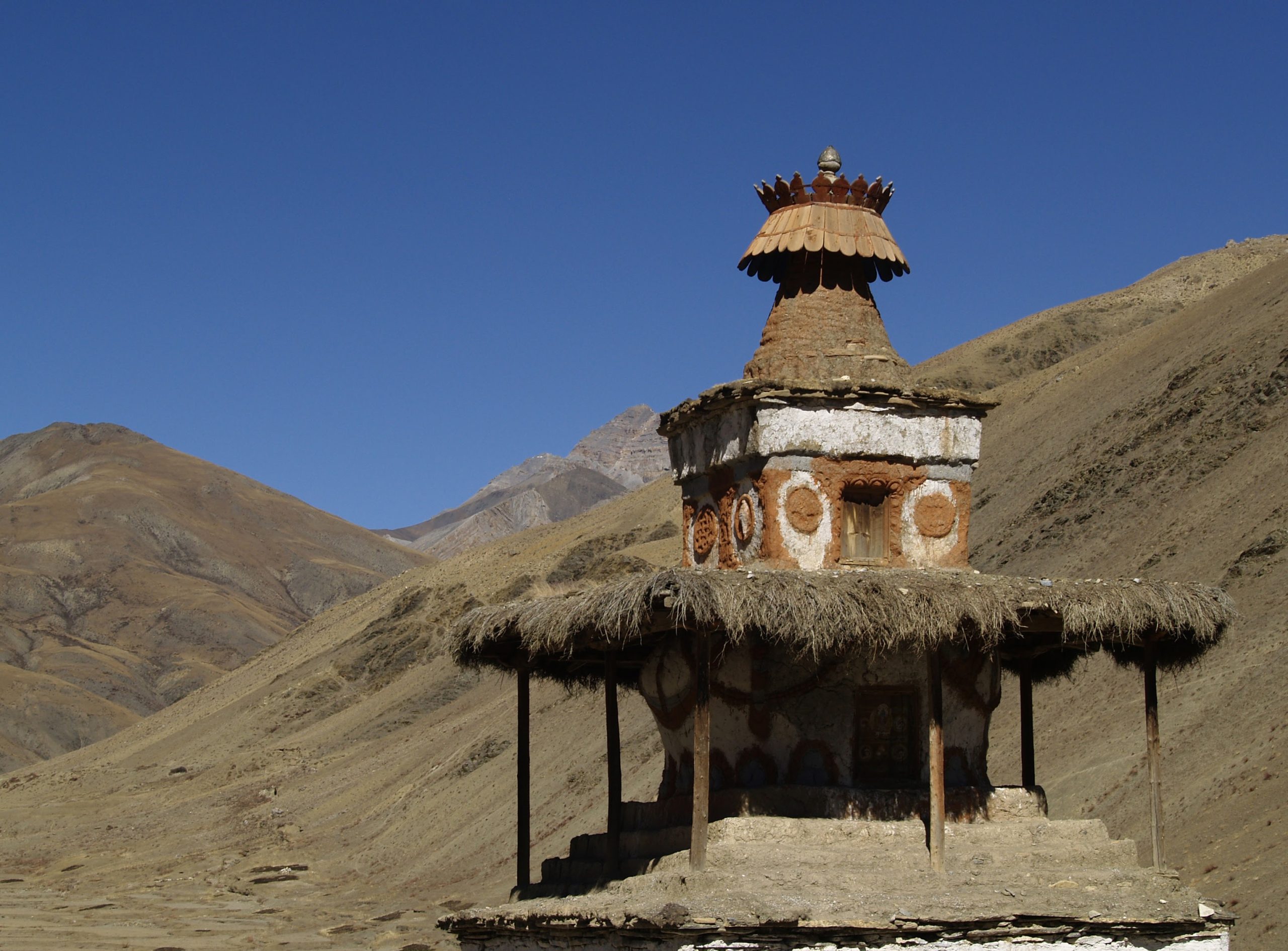
We climb through broad sweeping grassy slopes to a ridge at 4 260m only to descend once more and climb again up a long valley to the Jangla pass at 4 410m. In Tibetan, “Jang” means green, and “la” means pass, but “la” is the word for deity. It this case the deity is regularly invoked to permit passage over the pass, which is sometimes less green than white with plentiful snow. In his book Stones of Silence, George Schaller wrote of the view north from Jangla, “From here we look into a new world of remote peaks crowned by remoter snows, a Buddhist world in the heart of the Himalaya”. Looking toward the Kagmara and Kanjirroba ranges you can actually see the uplift of the Asia plate it is pushed up by the India plate. We are now in Dolpo and below us to the east is the old Kingdom of Tichurong, the Valley of Fragrant Water, the capital of which was Tarakot. To the north and west are the Kanjiroba and Patrasi ranges, Phoksumdo Lake, the Kagmara Lekh, and beyond, the vast expanse of the Tibetan Plateau, one of the most remote and isolated regions on earth. Dolpo’s people call it byang, “the north”, we are now poised on the spine of the Himalaya. Our descent from the pass brings us into the dryer crystalline landscapes of the Himalayan rain-shadow. From the pass we cross huge grassy slopes and soon can just barely make out the large town of Dunai. The administrative headquarters of Dolpo, deep in the valley haze of the Bheri River 2 400 m below! We reach a ridgeline to the east and follow the trail steeply down to the meadows above the Tichurong villages. Foxes and jackals have been seen in the forests in this area. These villages have been extremely isolated. In winter-four to six months-all passes into the area are thoroughly blocked by snow, and the only way out is a two to three weeks journey down the Bheri River. In the monsoon, the river south is usually impossible because of high water. We descend to our camp at Sahartara (2 730 m), a small interesting village having a gompa and a large, white chorten (a Buddhist shrine that one walks through, with many paintings inside). This is a long day with a 1 680 m descent from the Jangla pass.
We descend to the fascinating village of Tarakot, (2 340 m) known locally as Dzong or Fort. At one time there must have been a fort dominating the river gorge form the village’s ridge. Today it is a picturesque cluster of flat-roofed stone houses perched on a jutting rampart 300 m above the river. A short easy day is planned here to explore the town and surrounding area. This area, Snellgrove writes, “Is fantastically beautiful. Euphorbia grows from the rocks. There are little trees with copper-colored foliage and others with the leaves at the end of their branches turned red, so that from a distance they appear as great red flowers”. We descend from Tarakot. To lunch and camp (about 2 100m) at the valley floor next to the Bheri River where there is a police check post.
We will trek northeast along the Bheri River into infrequently traveled and increasingly isolated country. The new trail hugs the Tarap Khola closely, carving its way up the nearly vertical canyon walls while the river water below roars and surges through narrow crevasses and around huge granite boulders. We pass the Magar village of Kanigaon (2 490 m), where there is another police check post. This village is where the Barbung Khola, which comes from the east, enters the Tarap Khola essentially doubling its size and forming the Bheri River. Heading north from Kanigaon the path winds its way through several primeval stands of red cedar, some well over 30 m high and perhaps four hundred years old. Then after a steep rise, the Tarap Khola trail rounds a corner and enters a lengthy narrow valley thickly covered precipitously out of overhanging rock with the river wild and thundering below filling the ear with a mighty sound. Camp is at a clearing known as Lahini (3 120 m).
This is an exciting day. The trail climbs steeply for about two hours before traversing more gently up the canyon. There are many places where the trail has been cut into rock walls on the sides of the canyon, and there are sections where spans of logs have been built to bridge short segments. At one point the trail climbs on very steep, tiny rock steps between large rock walls. The trail has been much improved over the last two years. Previously this path was very precipitous and contributed to the isolation of Tarap. The trail crosses back and forth across the Tarap Khola several times. Camp is in a cleaning by the river called Shipka (3450 m).
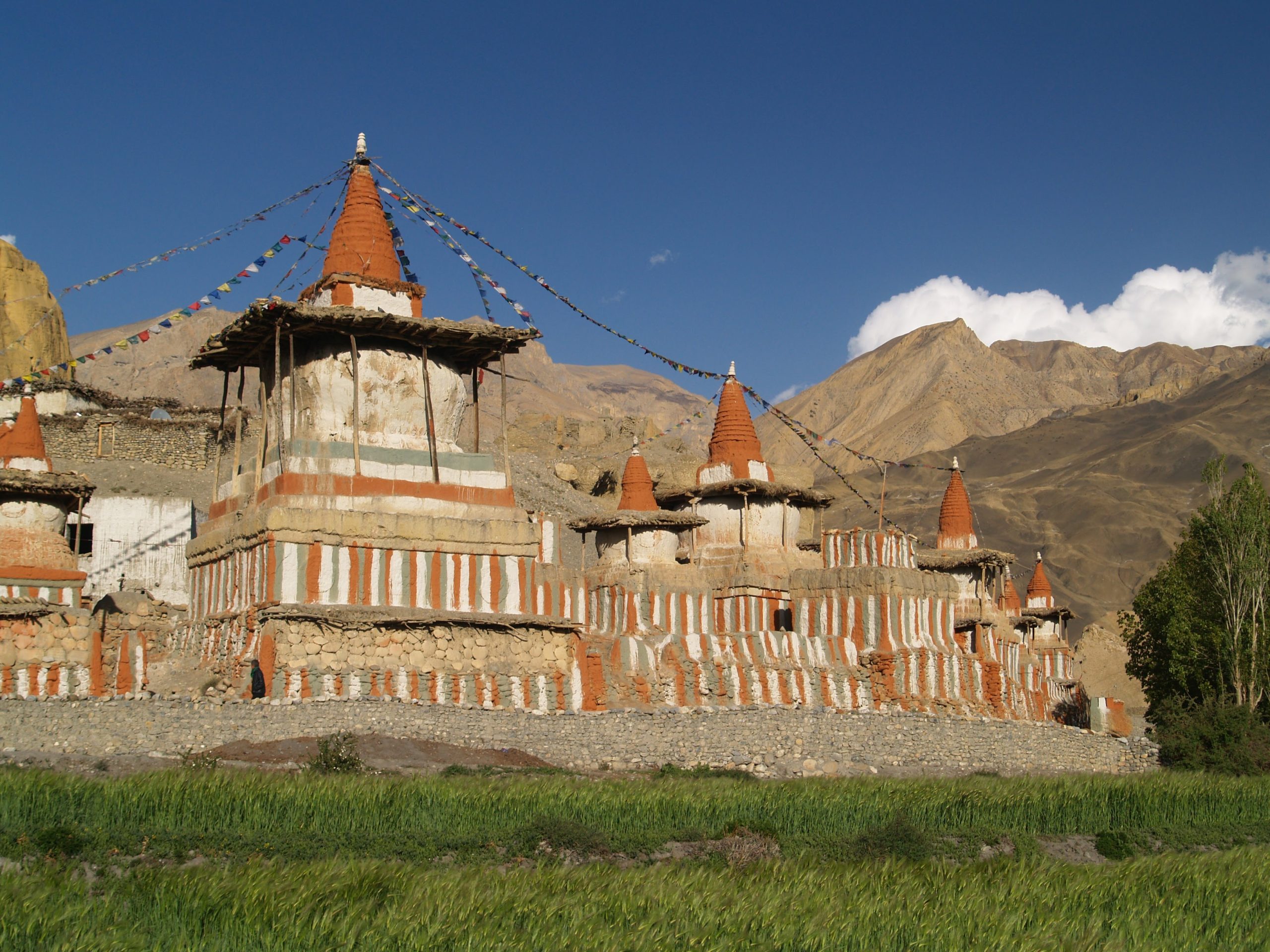
The trail continues up the Tarap Khola into increasing arid terrain. After passing numerous mani walls, we will reach Dho (Tarap gaon, 3 878 m), the main village of Tarap, by late afternoon. The village is surrounded by large chortens and is inhabited mostly by Magars who have lived here for generations and who speak Tibetan. The dress like Khampas (eastern Tibetans) in spite of their proximity to Western Tibet. This is a long but very interesting day.
As this is about a half day of trekking, we should have time to visit some of the monasteries around Dho. Of special interest is Ship Chhok Gompa, a Bon monastery about 30 minutes from our camp, and Guru Gompa, a Buddhist monastery above the village. We will continue up the Tarap Khola through meadows until we reach Kakar with its large red Gompa and the only school in the valley. Our route passes Ciumaga and Mondro as we climb gently towards the Qang La. We will take time to visit the Champa Gompa. We pass Tok Kyu, the last village, before reaching our campsite at about 4 230m.
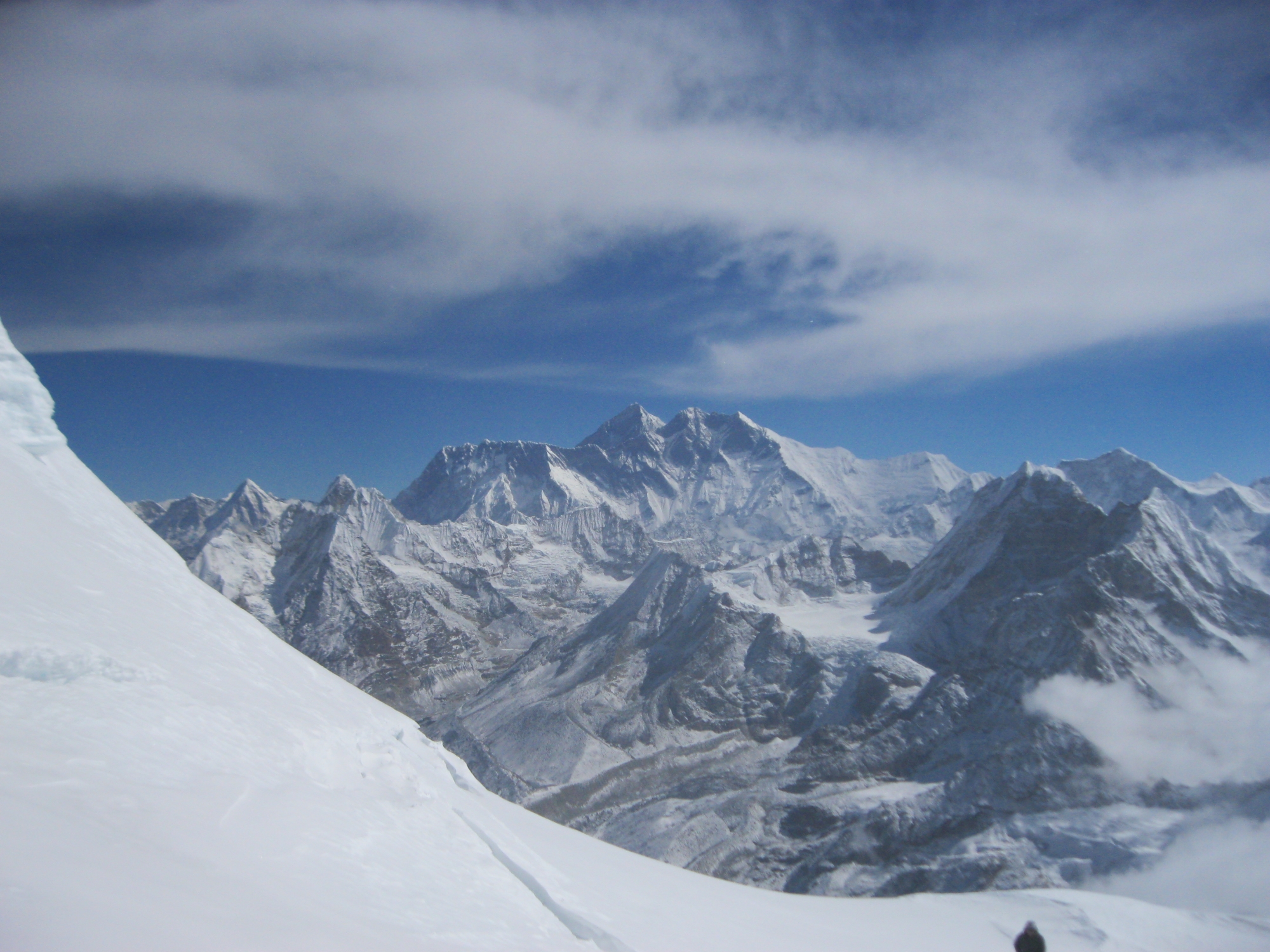
This is long, arduous but very beautiful day, there is a good chance we’ll see Blue Sheep. We start early and cross the dwindling Tarap Khola on a trail that is becoming less distinct as it approaches the first of two major high passes the Qang-La- at about 4 920 m. There are fine views of the area we have trekked so far. If the weather is clear, we will be able to see Dhaulagiri I and Dhaulagiri II. Lunch is after this first pass at a scenic spot where the Dho trail joins the Saldang caravan trail, over which the salt and grain trade has been conducted for centuries. There are fantastic views of the Kanjirroba peaks from our lunch spot. The climb up to second pass, the Se La, is gentle but nevertheless very exhausting because of the altitude. There will most likely be patches of snow on the top of this flat pass marked with mani stones and tattered prayer flags. Great panoramic views are to be had from this pass. The wide and well worn caravan trail descends steeply over screen from the Se La providing glimpses far to the west and north, and even into the land Lo (Mustang). Strong cold winds from the Tibetan Plateau pour over the Se La in the late afternoon. The trail to Lamoshey La branches off the caravan trail to the left. Thin and often hard to find and follow this less-used trail maintains a high traverse to the pass above Shey. Camp that night is likely to be the highest and coldest of the trek somewhere after descending from the Se La.
This is prime Snow Leopard country, and if there is snow, chances are we will see many tracks of this elusive animal crossing the trail. If we are lucky we might catch a glimpse of one again a long and arduous day. The high traverse to Lamoshey La does not rise and fall much, but it is razor thin and difficult to walk. Staying above 4 710 m we reach our next pass, the Lamoshey La at 5 010 m, and drop steeply to the other side. We are approximately 2 hours from Shey Gompa, and if we did not encounter much snow on the trail during the day or lose the trail, and everyone feels energetic, we can continue to Shey, otherwise we will spend the night at a campsite called Stone House (4 410m).
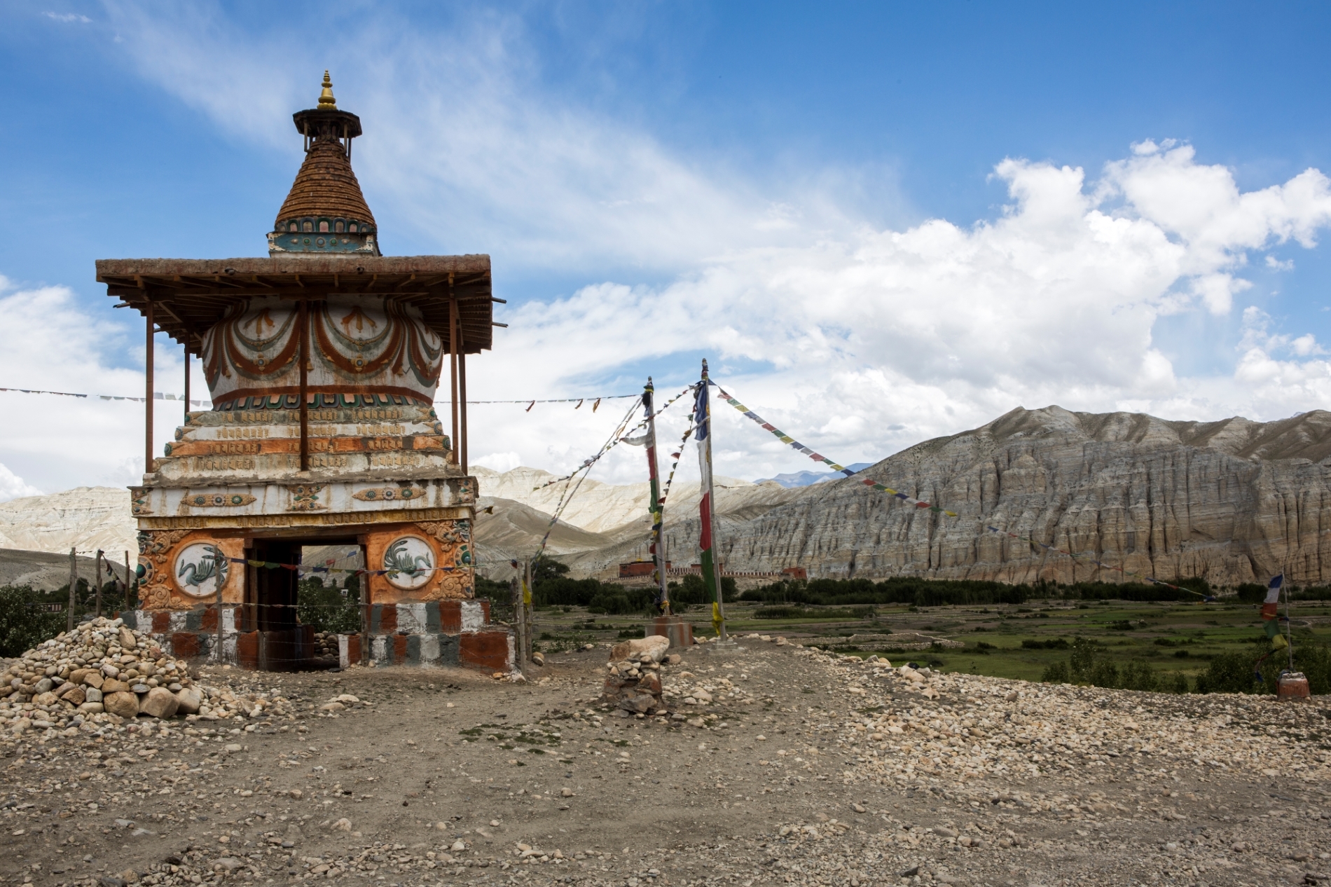
If we spent the night before at the Stone House camp, we will depart early morning for our short trek to Shey. The trail follows the riverbed then climbs gently, levels off, and contours the valley for about tow hours to Shey Gompa (4 140 m). On the way we might see local yak herders camping. Our first glance of the Gompa which is around sharp turn which is filled with a number of mani stones and prayer flags. A few minutes later we arrive at the Gompa which located at the intersection point of three valleys. This is a magic moment! We are at one of the most isolated places in to the world, and the past few hard days over the high passes make it all worthwhile. Next to the Gompa there is a field of thousands of mani stones which were brought here by pilgrims over the years.
The morning is free for rest and exploration. Shey Gompa is named after the “Crystal Mountain of Dolpo” which rises above the pass. We will spend the day exploring the Gompa and they valley. Crystal Mountain rises to the south-southeast of Shey Gompa, across the confluence of the Black and White Rivers. Highly recommended is the 410 m climb to Tsakang, or the red chalk gompa, the former home of Karma Tupjuk, the incarnate lama of Shy, who made such a profound impact upon Matthiessen and is built, Anasazi-like, into a cliff of red, Chalky sandstone. The air, light and sound have a clarity from this high perch that is like no other, confirming in a matter of moments the depth and power of all the description that Matthiessen gave to his memorable sojourn in Shey several decades ago. We may move camp this afternoon to a big grassy bowl at the foot of the Churang La pass that we will cross the next day.
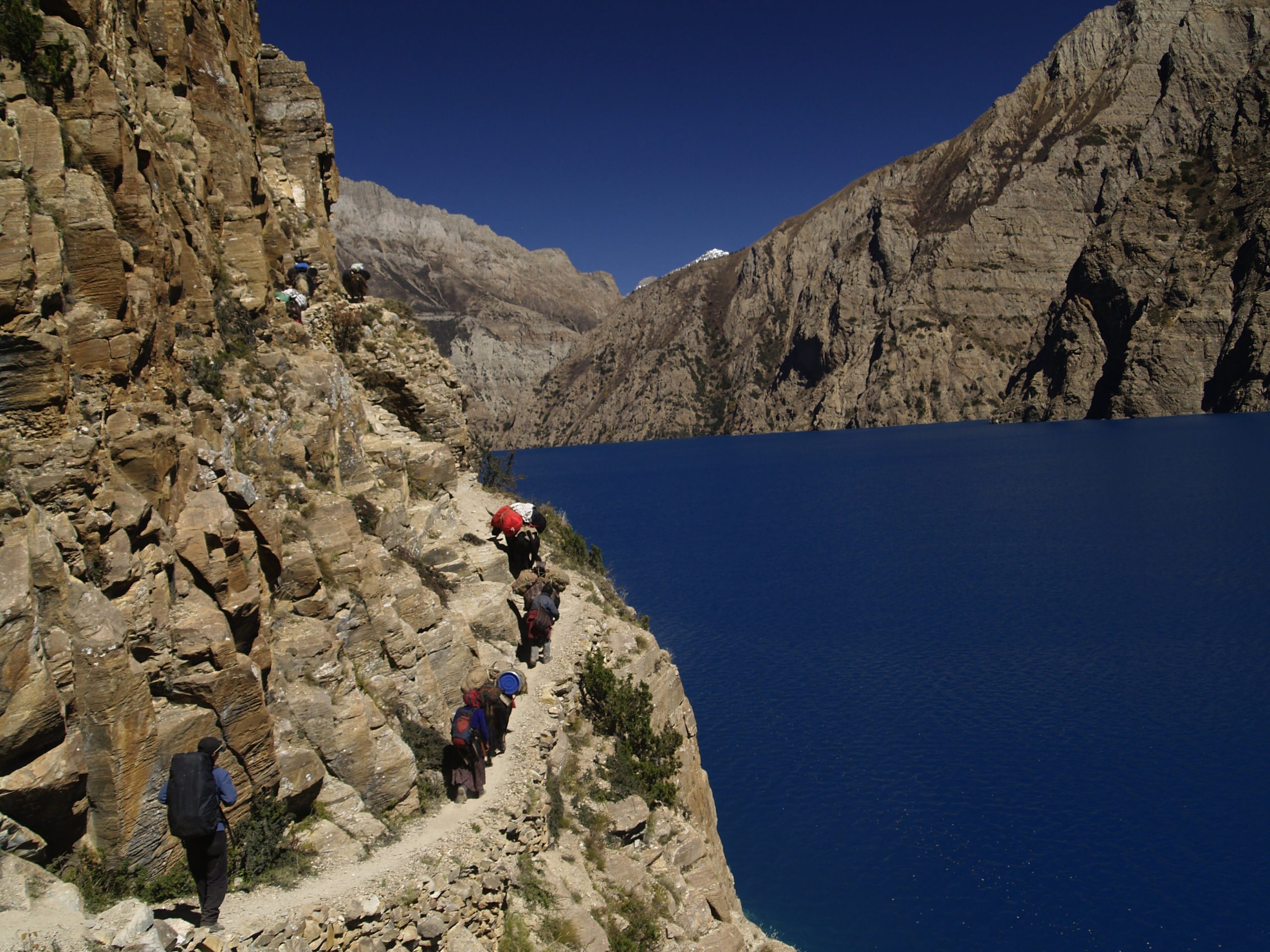
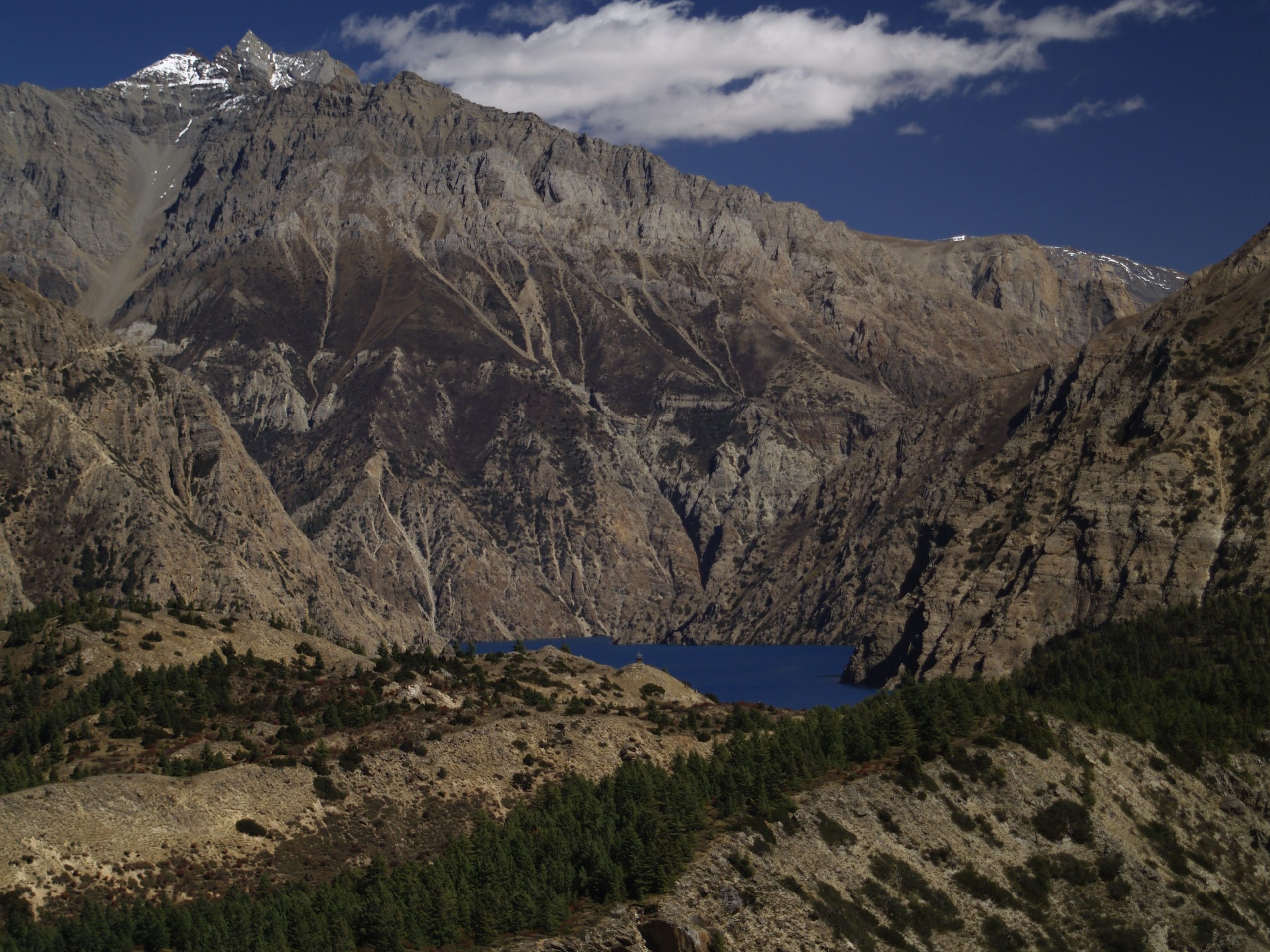
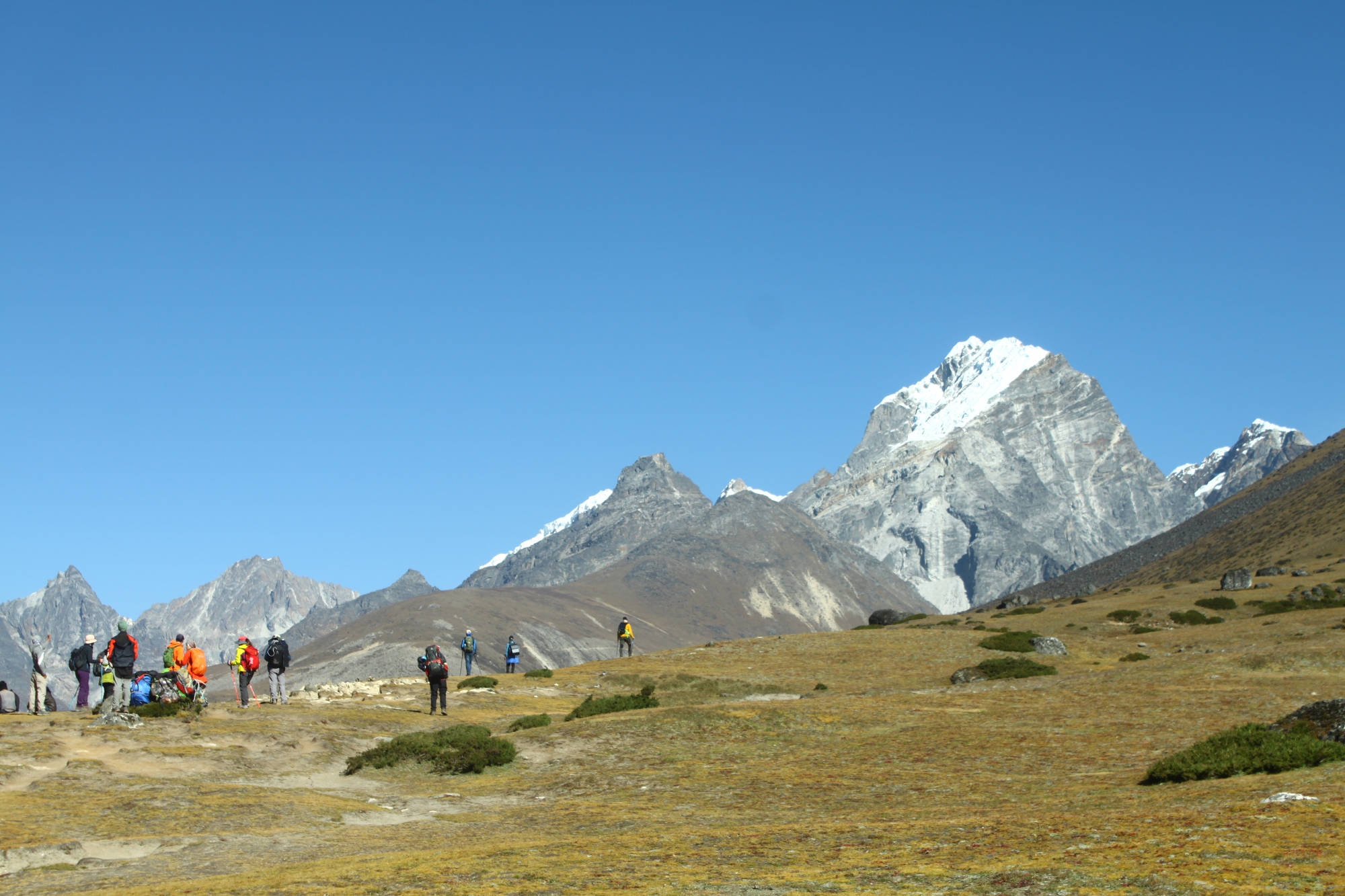
After an early morning start, we will pass by Black Pond where the trail divides. We follow the trail to the right which leads to the highest pass of the trek, the Churrang La, estimated to be 5 310 m. Snow is likely to cover this pass. A cairn and prayer flags mark the top of the pass. There are impressive rock falls to the left and brown barren hills to the right. After crossing the pass, we descend into a broad open valley to the southwest that, after an hour of walking, narrows, and then descends over loose, white screen for 450 m, whereupon the trail begins to approach the tree line that comes up from the lake and river some distance below. Straight ahead lays the monumental, snow covered northern face of the Kanjirobas, imposing and still. The trail descends close to the river, and then climbs abruptly for 300 m leveling off while passing through a birch forest into a beautiful, broad, open high meadow at the foot of the snowy Kankirobas. The trail then descends dramatically once again to a beautiful, forested campsite at the confluence of two turbulent rivers which feed the northwestern end of Phoksumdo Lake. This is a very long and demanding day.
The descent from the riverside camp to the northwestern edge of Phoksumdo Lake bears of the steepness of the previous day. Lunch is likely to be in a small birch grove where the trail meets the lake for the first time. It is here that Matthiessen and Schaller camped after negotiating the formerly treacherous trail around the western side of the lake height above the lake change, the intense, remarkable blue of the water emerges and shifts in ways that cannot be appreciated from the lake’s edge. It is blue like no other, the lake’s edge and follows a reasonably level course into the town of Ringmo. This trail has only recently been upgraded from the precarious route Matthiessen and Snellgrovp describe in their writings. This is where the Yak fell off the trail in the 1999 movie Himalaya.
In the morning we will visit Ringmo Gompa on the shores of the lake which contains some very old paintings. If the lama is in residence we hope to arrange an audience. In the afternoon we can visit Ringmo, a remainder of the day is free to fascinating hamlet populated by Tibetans and some Magars, mostly followers of Bon Po. Ringmo is just about 15 minutes from the lake. The remainder of the day is free to rest and explore the environs of this beautiful lake.
Leaving Phoksumdo Lake and descending, the awesome 270 m waterfall draining Phoksumdo Lake comes into view. This is the biggest waterfall in Nepal. We descend to the confluence of the Suli Gad with the Pungmo Nala to Sumdua, the site of a small military detachment protecting the park from poachers and antiquity thieves. We continue on to Mondro, a deserted winter village used by the people of Ringmo. Continuing down the Suli Gad we come to Regi, a tiny Gurung settlement, and then on to our isolated forested camp next to the river (2 670 m).
The trail continues down the Suli Gad, with some steep climbs to get around cliffs and some traversing of beautiful open grassy slopes high above the river. We cross the Suli Gad several times and pass through forests and grottos along the clear beautiful waters of the Suli Gad to the settlement of Chepka (2 580 m). This is a short beautiful day, and we may be in camp by lunch.
The trail continues down the Suli Gad to where it flows into the Bheri River. Heading upstream on the Bheri for about an hour we cross a new bridge to Dunai (2 070 m), the District Headquarters and the first large town since we left Beni. Camp will be made in Dunai.
We follow the south side of the Bheri River for about an hour. We then climb for about three hours to the village of Jafal, the location of the Dunai airfield. This is a steeply inclined STOL field carved out of the hillside. It about 420 m above the Bheri River. That evening we will have a party with our staff that has been with us for 29 days. Camp at Jafal (2 610 m).
Fly from Jafal to Nepalgung & connecting flight to Kathmandu.
On this last free day you have plenty of opportunity to enjoy more sights in Kathmandu: you can make a daytrip to the splendid five storied Nyatapola Temple and exquisite woodcarvings like the Peacock window in medieval Bhaktapur, climb the long stairs to the stupa of Swayambhunath (Monkeytemple) or visit the sleeping Vishnu at Budhanilkantha. You can also shop, relax and drink coffee in the bakeries of Thamel or the Garden of Dreams. Traveltimes Treks recommends you plan one extra day at the end of your trekking in case in case of delayed schedules during your travel.
Transfer to Tribhuvan Airport – We hope you enjoyed your stay!
Extra days:
If you wish to stay longer in Nepal: Traveltimes Treks can offer you plenty of suggestions, we can arrange rafting and safari trips, helicopter flights, mountainbiking, multi day tours to the old historical city of Bhaktapur, the mountain stations Nagarkot & Dhulikhel or retreats in the serene monasteries of Namobuddha and Kopan.
Trip Format
The trek is non-technical and suitable for anyone in good physical shape who likes to hike over mountain trails and camp out. You should be in good physical shape for this trip and feel comfortable hiking 12 to 20 km per day on a trail while carrying a day pack of about 5 kg. The trek crosses many passes, the highest at about 5 330 m, and should be considered moderate strenuous. On some days altitude gains and losses of up 1 200 m can be expected. There is one descent of 1 700 m. Strengthen your knee muscles and prepare steep descents.
A program of cardiovascular conditioning such as running, swimming, biking or aerobics is essential, but try to supplement your exercise with hiking on steep hills or running up and down steps. The more you can condition by closely simulating the activities of trekking, the better off you will be. While the trip is rated as moderate, good conditioning is essential to your enjoyment of the trek.
Remember that, the latitude of Nepal is between 26 °C and 30 °C so it will warm at the lower elevations (short and T-shirt) while nights will be cool to cold depending on the elevation. Daytime temperatures will be between 10°C and 20°C at the lower elevations and between 0°C and 10°C at our highest elevations. Temperatures at night will in general be cool, ranging from 0°C to 5°C except for the nights in inner Dolpo where temperatures of -10°C occur at night. It might even get as low as -15°C at the coldest part of the night. The weather is generally sunny, although an occasional storm could occur.
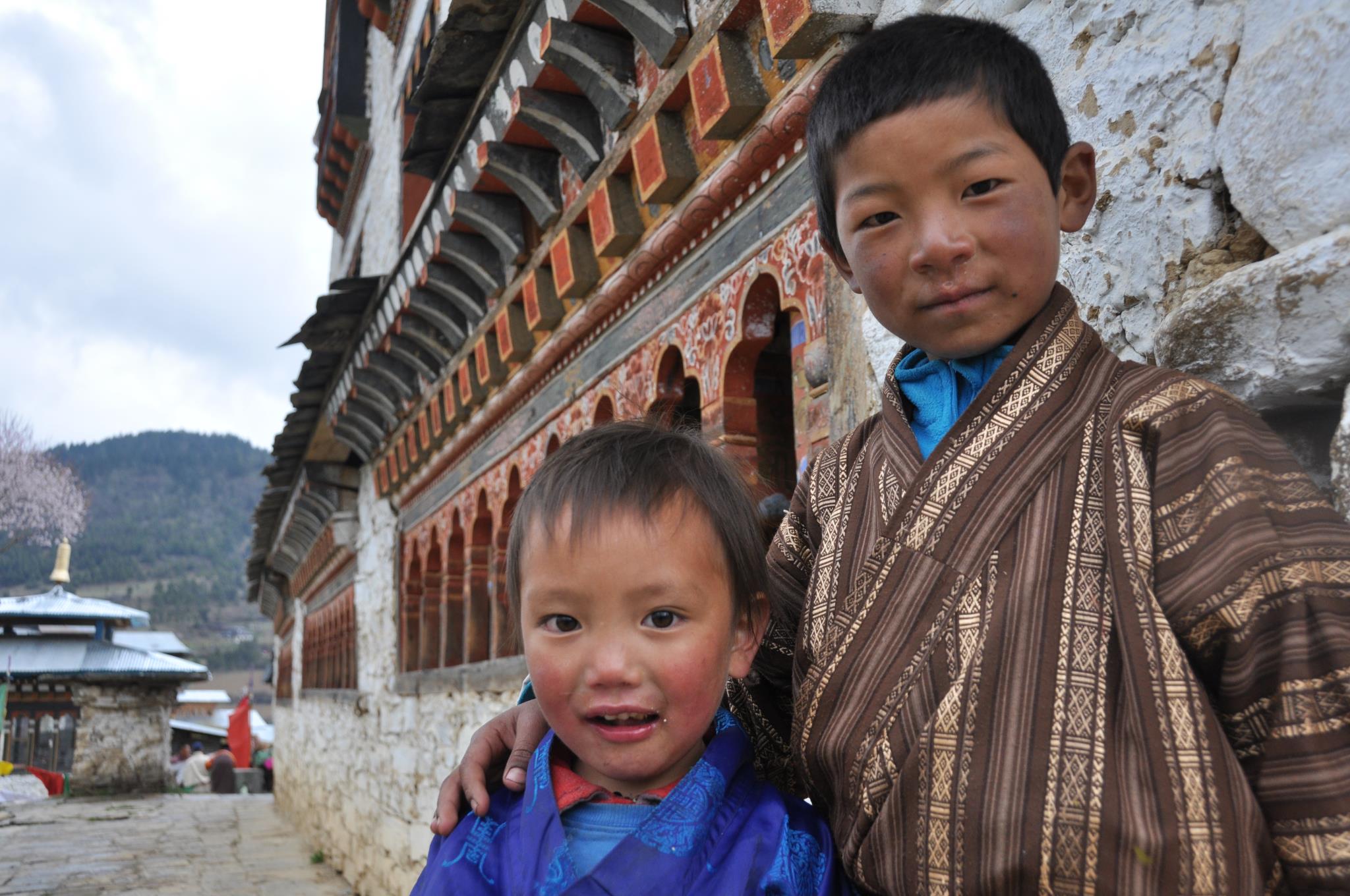
The pace on the trek will be leisurely and unregimented. You are encouraged to walk by yourself or in small groups. Take time to visit local houses and temples, share a cup of tea or rakshi with our porters and the locals in the many chiyaa houses. Pursue interests in photography, bird-watching and botany, and sample the culture of the area you are traveling through. The trip will emphasize cultural interaction with both our staff and local villagers.
We will have a GAMOW bag on the trip which is portable hyperbaric chamber that looks like an inflatable extra-large sleeping bag. It will be useful should anyone have altitude problem on the trek. The effective altitude inside the inflated GAMOW bag is about 1 500 m lower than the altitude you are at; it has been very effective in past years in relieving headaches and other symptoms of altitude sickness.
Personal gear will be carried by porters. They will carry three members’ duffel bags. Since their load is 30 kg, this means that your duffel cannot exceed ten kilos. Tents are provided and are carried separately. You will be expected to share your tent with one other person. Our guides, besides making sure we do not get lost, also pitch and take down the tents and are responsible for supervising the porters and evening camps. We will have one guide in front, one in the rear and, for full trips, and one who float throughout the group. They will be under the direction of the head guide or Sirdar who speaks excellent English.
Our kitchen staff is truly amazing. They are well trained in western tastes and standards of hygiene. A typical day may see you being offered lemon tea and cookies when you awake, juice and tomato omelet for breakfast, stir-fried vegetables and salami for lunch, tea and cookies when you arrive at the evenings campsite, and fresh lentil soup and Tibetan momo (potstickers) for dinner. Our cooks have even been known to bake cakes over a double boiler arrangement. Our kitchen crew cooks on kerosene stoves instead of using wood so as not to add to Nepal’s growing deforestation problem. We try to offer you a good mix of native dishes as well as western style dishes.
We do not bring tables on the trek. We all eat on the ground or on the camp stools around a big kitchen tarp, and we have a dining tent that can be pitched in case of rain, wind, or cold. In an attempt to minimize the amount of fuel we use, we provide one large bucket of hot water every day either in the morning or afternoon for washing. We do not routinely provide hot water to each tent as this waste too much fuel. A toilet tent is set up at each camp around a pit toilet. Each member is issued a bottle of iodine water-purification solution.
This is not a tour where everything can be planned in advance to run like clockwork. You probably won’t experience exactly what is written in the daily itinerary. Often adjustment must be made in the field. We want you to participate in the trip with the clear understanding that things can go wrong. Adventure travel does involve certain risks both emotional and physical. One has to be flexible when traveling in Nepal and have a cheerful attitude.
Included in the Cost
- All airport transfers.
- All sightseeing in Kathmandu including guide, vehicle and entry fees for World Heritage Centers.
- Twin-sharing accommodation in 2 ** hotel in Kathmandu.
- All the needed camping equipments.
- Assistance of our staff, adequate equipment for our staff, salaries, food and trekking insurance.
- 3 meals and warm drinks during trek.
- Private bus transfer Kathmandu-Baglung, flight ticket Jafal-Pokhara & flight ticket Pokhara-Kathmandu.
- Shey Phoksumdo National Park Fee and Annapurna Conservation Area fee & TIMS (Trekking Information Management System) card.
- GAMOW bag or high altitude pressure chamber and pulse oximeter.
- Satellite phone.
Not Included in the Cost
- International flights, airport taxes, visa fee for Nepal.
- Personal items, travelling insurance including emergency helicopter rescue/evacuation (required).
- Trekking gear including sleeping bag, appropriate clothing.
- Meals in Kathmandu except welcome dinner in Kathmandu.
- Cold drinks or bottled/canned beverages including soft drinks, alcoholic beverages and water (bottled) during trek and in Kathmandu.
- Tips and expenses of personal nature.
| Start date | End date | Price | Status | Book |
|---|---|---|---|---|
| September 10, 2023 | October 11, 2023 |
5200 Per Person
|
available | Book Now |
Map
Related Tours
Mera Peak
Lobuche East 6119 m
Mustang Photography Tour
Snowman Trek
Jhomolhari Trek